
1951 Map of Fair Grove
USGS Topo · Published 1952About this map
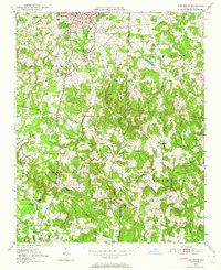
Thomasville expands southward in this early 1950s survey, transitioning from industrial rail hubs into a landscape of small agricultural settlements and rural congregations. The corridor of the High Point Thomasville and Denton RR defines the western edge of the quadrangle, passing through Hannersville Station and near Walser. This area is particularly detailed in its religious and community geography, noting numerous rural landmarks such as Emanuel Ch, Clarksbury Ch, and Mt Carmel Cem.
Find a feature on this map
41 named features on this map. Tap any name to fly to it.
Don’t see what you’re looking for? This feature index may not catch every label — zoom into the map to look around manually.
Map Details
Editions of this 1951 Fair Grove Map
4 editions found
Other maps of this area

1949 · Denton NW
USGS Topo · 1:24,000

1949 · Eller
USGS Topo · 1:24,000

1949 · High Point West
USGS Topo · 1:24,000

1950 · High Point East
USGS Topo · 1:24,000

1950 · Lexington East
USGS Topo · 1:24,000

1951 · Lexington East
USGS Topo · 1:24,000

1951 · High Point East
USGS Topo · 1:24,000

1953 · Raleigh
USGS Topo · 1:250,000

1953 · Charlotte
USGS Topo · 1:250,000

1954 · Charlotte
USGS Topo · 1:250,000