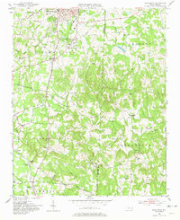
1951 Map of Fair Grove
USGS Topo · Published 1981About this map
Thomasville sits at the northern edge of this Piedmont landscape, serving as a primary hub where the High Point and Thomasville railroad intersects with local commerce. The surrounding countryside is defined by the headwaters of the Little Uwharrie River and its various tributaries like Hamby Creek and Brier Creek, which have historically dictated the placement of small rural settlements. Small communities such as Glen Anna, Walser, and Gordontown are scattered throughout the Conrad Hill and Tabernacle districts, many anchored by country churches like Emanuel Ch and Clarksbury Ch.
Find a feature on this map
40 named features on this map. Tap any name to fly to it.
Don’t see what you’re looking for? This feature index may not catch every label — zoom into the map to look around manually.
Map Details
Editions of this 1951 Fair Grove Map
4 editions found
Other maps of this area

1949 · Denton NW
USGS Topo · 1:24,000

1949 · Eller
USGS Topo · 1:24,000

1949 · High Point West
USGS Topo · 1:24,000

1950 · High Point East
USGS Topo · 1:24,000

1950 · Lexington East
USGS Topo · 1:24,000

1951 · Lexington East
USGS Topo · 1:24,000

1951 · High Point East
USGS Topo · 1:24,000

1951 · Fair Grove
USGS Topo · 1:24,000

1953 · Raleigh
USGS Topo · 1:250,000

1953 · Charlotte
USGS Topo · 1:250,000