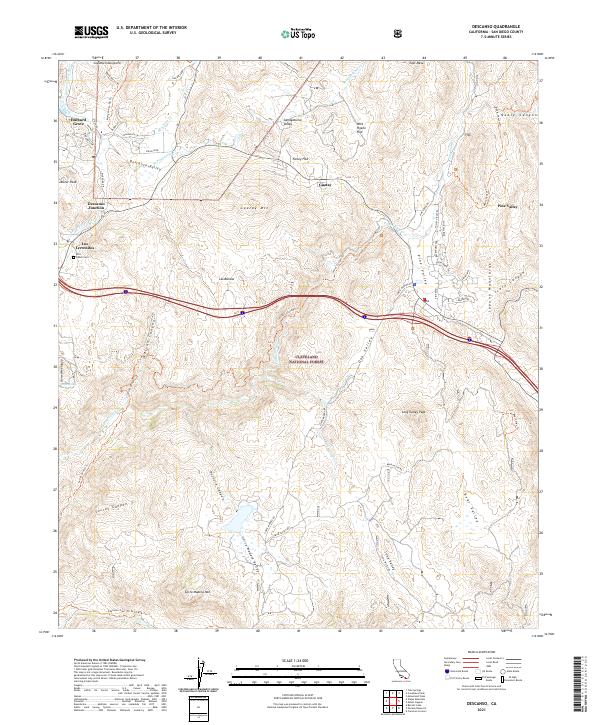
2021 Map of Descanso
USGS Topo · Published 2021About this map
Cleveland National Forest dominates this interior San Diego County landscape, where the high mountain terrain breaks into complex canyon systems. The settlement pattern is concentrated along the arterial corridor of Descanso Valley and the highway, connecting Hulburd Grove through Descanso Junction to the community of Pine Valley. This area serves as a rugged gateway to the Laguna Mountains, characterized by family ranching history such as that found at the Ellis Ranch Cem near Los Terrenitos. The geography is defined by steep relief, from Guatay Mtn and Corte Madera Mtn down into the depths of Secret Canyon and Nelson Canyon. This 2021 update documents the extensive network of fire roads and trails, including the Noble Canyon Trl and Espinosa Trail, that traverse the watershed of the Sweetwater River.
Find a feature on this map
58 named features on this map. Tap any name to fly to it.
Don’t see what you’re looking for? This feature index may not catch every label — zoom into the map to look around manually.
Map Details
Editions of this 2021 Descanso Map
This is the sole edition of this map. No revisions or reprints were ever made.
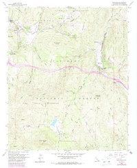
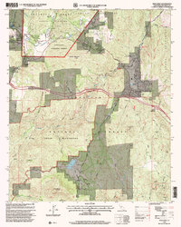
Historical Maps of Descanso Junction Through Time
3 maps found