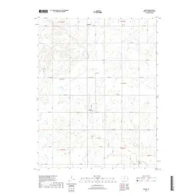
2018 Map of Devon
USGS Topo · Published 2018About this map
Devon and Harding anchor this Bourbon County landscape, where the prairie transitions into a network of small drainage basins. The Little Osage River defines the northern reaches, while a series of cemeteries scattered across the township grid, including Avondale Cem, Centerville Cem, and Dayton Cem, provide essential touchstones for genealogical research. The land is organized by a disciplined grid of rural roads, such as Tomahawk Rd and Soldier Rd, reflecting the agrarian settlement patterns that have persisted for generations. Waterways like Honey Cr and Clever Cr thread through the terrain, illustrating the drainage patterns that feed into Mill Creek. This 2018 survey reveals the enduring rural character of the region, where family history is etched into the landscape via remote burial grounds like Zion Cem and West Plains Cem.
Find a feature on this map
50 named features on this map. Tap any name to fly to it.
Don’t see what you’re looking for? This feature index may not catch every label — zoom into the map to look around manually.
Map Details
Editions of this 2018 Devon Map
This is the sole edition of this map. No revisions or reprints were ever made.
Other maps of this area

1884 · Fort Scott
USGS Topo · 1:125,000

1886 · Fort Scott
USGS Topo · 1:125,000

1887 · Mound City
USGS Topo · 1:125,000

1893 · Fort Scott
USGS Topo · 1:125,000

1893 · Mound City
USGS Topo · 1:125,000

1947 · Lawrence
USGS Topo · 1:250,000

1947 · Joplin
USGS Topo · 1:250,000

1949 · Joplin
USGS Topo · 1:250,000

1950 · Lawrence
USGS Topo · 1:250,000

1954 · Joplin
USGS Topo · 1:250,000