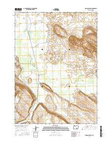
2017 Map of Diamond Swamp
USGS Topo · Published 2017About this map
Donner und Blitzen River snakes through this high desert basin, feeding an intricate network of irrigation and drainage features that define the local ranching and water management history. The map shows the structural complexity of Diamond Swamp and the managed flow of the Center Canal, Skunk Farm Canal, and S Diamond Canal. To the east, the volcanic legacy of the region is prominent at Diamond Craters, where distinct contour lines reveal the unique geology of the Lava Beds Rd area. Elevated landmarks like Buena Vista Butte and Jackass Mtn provide visual anchors above the wetlands. This 2017 survey details the intersection of natural hydrology and human engineering, from the quiet waters of Buena Vista Lake to the vital sources at Oliver Spring and Hog Wallow Spring.
Find a feature on this map
26 named features on this map. Tap any name to fly to it.
Don’t see what you’re looking for? This feature index may not catch every label — zoom into the map to look around manually.
Map Details
Editions of this 2017 Diamond Swamp Map
This is the sole edition of this map. No revisions or reprints were ever made.
Other maps of this area

1955 · Burns
USGS Topo · 1:250,000

1955 · Adel
USGS Topo · 1:250,000

1957 · Adel
USGS Topo · 1:250,000

1958 · Burns
USGS Topo · 1:250,000

1958 · Adel
USGS Topo · 1:250,000

1959 · Burns
USGS Topo · 1:250,000

1962 · Adel
USGS Topo · 1:250,000

1967 · Coyote Buttes
USGS Topo · 1:24,000

1967 · Krumbo Reservoir
USGS Topo · 1:24,000

1967 · Jackass Butte
USGS Topo · 1:24,000