2022 Map of Dickeyville
USGS Topo · Published 2022About this map
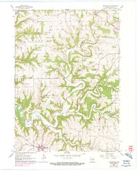
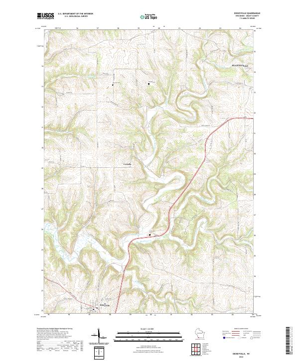
The Little Platte River and its numerous tributaries, including Blockhouse Cr and Whig Br, carve a complex drainage pattern through this section of Grant County. The settlement of Dickeyville anchors the southwest corner of the map near the Great River Rd, while the village of Cornelia sits centrally atop the ridges. This landscape is defined by the transition from upland agricultural plateaus to the deep-cut stream valleys that feed toward the Mississippi. Local history and genealogy are well-represented by several rural burial sites, such as the Holy Ghost Cem and Piddington Cem. In the northeast, the outskirts of Platteville appear near the Rountree Br, showing the encroachment of urban development into the surrounding farm country during the early twenty-first century.
Find a feature on this map
64 named features on this map. Tap any name to fly to it.
Don’t see what you’re looking for? This feature index may not catch every label — zoom into the map to look around manually.
Map Details
Editions of this 2022 Dickeyville Map
This is the sole edition of this map. No revisions or reprints were ever made.