2021 Map of Dilkon
USGS Topo · Published 2021About this map
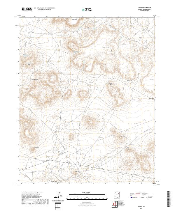
Cedar Springs and the surrounding volcanic buttes define the landscape of the Navajo Nation captured in this 2021 survey. The terrain is characterized by dramatic elevation changes, moving from the low drainage of Coyote Wash and Tees Toh Wash up to prominent landmarks like Dilkon Hill and Eagle Nest Point. The distribution of natural water sources, including Tsi Na Jinnie Spring and Mountainside Spring, illustrates the critical points of life in this arid high-desert environment. A network of routes such as Indian Rte 15 and Indian Rte 60 connect the dispersed homesites and mesas, reflecting a modern infrastructure that follows the natural contours of the mesas and washes. This map is particularly useful for observing how geographic features like Lone Cottonwood Butte and Twin Buttes serve as navigational anchors in a vast, open territory.
Find a feature on this map
33 named features on this map. Tap any name to fly to it.
Don’t see what you’re looking for? This feature index may not catch every label — zoom into the map to look around manually.
Map Details
Editions of this 2021 Dilkon Map
This is the sole edition of this map. No revisions or reprints were ever made.
Historical Maps of Cedar Springs Through Time
Featured Locations
- United States
- Fort Defiance Agency
- Navajo County, AZ
- Cedar Springs, Fort Defiance Agency
- Dilkon, Fort Defiance Agency