Old Maps of Navajo County, Arizona
Explore 1,249 old maps of Navajo County, spanning from 1883 to today. These high-resolution historic maps reveal how streets, neighborhoods, landmarks, and natural features evolved over time — perfect for genealogy, metal detecting, research, and local history exploration.
What you can do with these maps:
- See how Navajo County changed over time: Compare historical maps to modern-day views to trace roads, homesites, rail lines & more.
- View detailed metadata: Each map includes creators, publishers, year, scale, and archive source.
- Overlay maps with satellite & LiDAR: Visualize the past alongside modern tools to explore terrain & human change.
- Trusted historical sources: Maps sourced from the USGS, Library of Congress, and other archives.
- Access maps your way: View online, download high-res files, or order prints for personal or research use.
Start exploring old maps of Navajo County to uncover forgotten places, hidden landmarks, and the deep history beneath your feet.
Navajo County, AZ maps
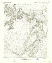
(1,249)- 1883 Map of Marsh Pass
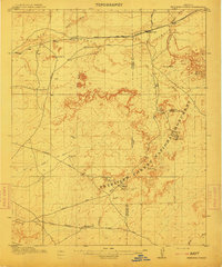
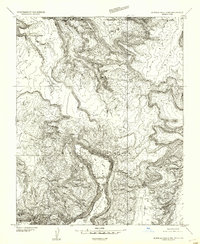
 1883 Marsh Pass1883 Print · USGSNortheastern Arizona was a complex labyrinth of mesas and canyons when this survey was conducted in the early 1880s. Researchers can locate critical desert water sources like Na-pai-bi-to Spring Lake and landmarks like Aga-thla Needle.
 - 1883 Map of Tusayan, 1896 Print
 1883 Tusayan1896 Print · USGSNortheastern Arizona's high desert was entering a period of rapid transition in the 1880s as traditional Hopi life met the expansion of the rail system. Genealogists and historians can trace the foundations of Winslow or explore ancient villages like Oraibi and Walpi.
 - 1886 Map of St Johns
 1886 St Johns1886 Print · USGSApache County in the 1880s was a landscape of emerging pioneer outposts and high-plateau cattle ranching. Researchers can trace the early footprints of settlements like St Johns and Erastus or locate the original path of the Atlantic and Pacific Railroad.
 - 1886 Map of Tusayan
 1886 Tusayan1886 Print · USGSArizona's high desert during the 1880s reveals a unique meeting of ancient mesa villages and the advancing rail line. Genealogists and historians can trace mesa settlements like Wolpi and Oraibi or early rail towns including Brigham City and Winslow.5 unique versions available
 - 1886 Map of Fort Defiance
 1886 Fort Defiance1886 Print · USGSTerritorial Arizona and the high plateaus of Apache County come to life in the 1880s, centered on the strategic outpost of Fort Defiance. Researchers can trace the path of the Atlantic and Pacific Railroad and locate early stops like Allantown and Navajo.
 - 1886 Map of Henry Mountains
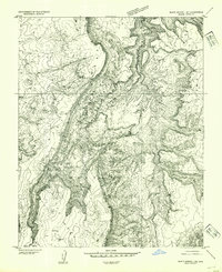
 1886 Henry Mountains1886 Print · USGSSouthern Utah remains a wilderness of deep canyons and volcanic peaks in this 1880s survey. Researchers can trace the original courses of the Colorado River through Cataract Canyon and find landmarks like Navajo Mt and Monument Valley.
 - 1886 Map of Holbrook
 1886 Holbrook1886 Print · USGSArizona's high desert and the Mogollon Rim frontier are captured here in the late nineteenth century during the height of early pioneer settlement. Trace the growth of river towns like Holbrook and Snowflake or locate remote outposts such as Wilford, Adair, and Heber.
 - 1892 Map of Fort Defiance
 1892 Fort Defiance1892 Print · USGSNorthern Arizona in the late nineteenth century remains a frontier of isolated outposts and high desert mesas. Trace the path of the A & P R R through Sanders or locate the remote station at Pueblo Colorado and the springs at Jacobs Well.6 unique versions available
 - 1892 Map of Marsh Pass
 1892 Marsh Pass1892 Print · USGSNortheastern Arizona and the Navajo lands are shown in the late nineteenth century as a series of immense mesas and critical water sources. You can trace early trails through Marsh Pass and locate remote landmarks like the Agathla Needle or Chil-Chi-Vi-To Spring.4 unique versions available
 - 1892 Map of St Johns
 1892 St Johns1892 Print · USGSArizona's eastern frontier is documented here in the late nineteenth century as cattle ranching and early settlements followed the path of the river. Genealogists and historians can trace the foundations of St Johns and Springerville or locate long-standing sites like Erastus and Windmill Ranch.5 unique versions available
 - 1892 Map of Henry Mountains
 1892 Henry Mountains1892 Print · USGSSouthern Utah in the late 1800s remains a wilderness of deep canyons and isolated peaks under the direction of J.W. Powell. Geologists and historians can trace the geological spine of the Water Pocket Fold and the early boundaries of the Navajo Indian Res. near Monument Valley.6 unique versions available
 - 1893 Map of Holbrook
 1893 Holbrook1893 Print · USGSNortheastern Arizona in the 1880s reveals a landscape of nascent ranching towns and deep canyon systems along the high plateau. Genealogists and historians can trace the early footprints of Holbrook, Snowflake, and Showlow as they appeared before the turn of the century.4 unique versions available
 - 1912 Map of Petrified Forest
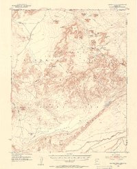
 1912 Petrified Forest1912 Print · USGSArizona's high desert was a remote frontier of fossils and rail travel just after the turn of the century. Genealogists and historians can trace early outposts like Adamana and Ortegas Ranch or locate archeological sites such as Indian Ruins and The Pictographs.2 unique versions available
 - 1947 Map of Flagstaff, 1948 Print
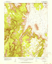
 1947 Flagstaff1948 Print · USGSThe Arizona high country and the Painted Desert converge in this post-war survey. Researchers can trace the ancient mesa villages of Walpi and Oraibi, the early roads of Flagstaff, and landmarks like Sunset Crater National Monument.2 unique versions available
 - 1952 Map of Shato Spring 1 NE, 1954 Print
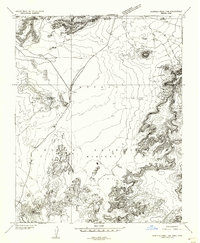
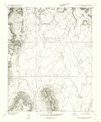
 1952 Shato Spring 1 NE1954 Print · USGSThe Navajo Nation's high-country terrain is captured here in the early fifties, documenting a landscape of mesas and valleys. Researchers can trace traditional habitation sites at Hogans and find vital water sources like Shato Spring and the Sage Valley floor.
 - 1952 Map of Agathla Peak 1 NW, 1954 Print
 1952 Agathla Peak 1 NW1954 Print · USGSThe Navajo Nation's high desert landscape is captured in the early fifties, documenting a region of massive buttes and ancient archaeological sites. Researchers can locate significant landmarks like the Ruin Pueblo (Site), the House of Hands, and Mitchell Butte.
 - 1952 Map of Agathla Peak 2 SW, 1954 Print
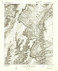 1952 Agathla Peak 2 SW1954 Print · USGSThe high plateau and deep canyon country of the Navajo Reservation are captured in the early fifties before major infrastructure arrived. Researchers can locate archaeological Ruins and trace the paths through Keet Seel Canyon and Tsegi Canyon.
 - 1952 Map of Agathla Peak 2 NW, 1954 Print
 1952 Agathla Peak 2 NW1954 Print · USGSThe high desert borderlands of the Arizona-Utah line appear in detailed relief in the early fifties, just as aerial photogrammetry was transforming western mapping. Researchers can trace the rugged topography of Skeleton Mesa and landmarks like Big Point or Todicheenie Bench.
 - 1952 Map of Boot Mesa, 1954 Print
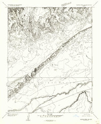
 1952 Boot Mesa1954 Print · USGSThe Navajo Indian Reservation and Monument Valley appear here in the early fifties, before modern development reached these remote canyonlands. Researchers can locate significant archaeological sites like Keet Seel Ruin and geologic landmarks such as Boot Mesa and Hat Rock.3 unique versions available
 - 1952 Map of Agathla Peak 1 NE, 1954 Print
 1952 Agathla Peak 1 NE1954 Print · USGSThe high desert of the Navajo Nation comes to life in this mid-century survey of the iconic borderlands. Geologists and historians can trace the intricate terrain around Echo Cave Ruin and landmark spires like West Mitten Butte and the Totem Pole.
 - 1952 Map of Clay Hills 3 SW, 1954 Print
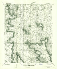 1952 Clay Hills 3 SW1954 Print · USGSThe high desert borderlands of San Juan County and the Navajo Nation are meticulously captured in the early 1950s. Researchers can trace the winding Trail through Copper Canyon and locate landmarks like Jacobs Monument and Hoskinnini Mesa.
 - 1952 Map of Agathla Peak 2 SE, 1954 Print
 1952 Agathla Peak 2 SE1954 Print · USGSThe northern Arizona plateau appears here during the early 1950s, showing the high Tyende Mesa and the wide Navajo Indian Reservation. Researchers can trace a historic Wagon Trail and find remote landmarks like a solitary windmill and Half Dome.
 - 1952 Map of Agathla Peak 1 SE, 1954 Print
 1952 Agathla Peak 1 SE1954 Print · USGSNortheastern Arizona and the high desert of the Navajo Nation are captured here in the early fifties. Local researchers can trace the course of Laguna Creek past Baby Rocks and across the Navajo Co and Apache Co line.
 - 1952 Map of Agathla Peak 2 NE, 1954 Print
 1952 Agathla Peak 2 NE1954 Print · USGSThe Navajo borderlands of Arizona and Utah are captured here in the early 1950s, showing a landscape defined by deep washes and high-desert flats. Researchers can locate the Hogan Church and trace the paths of Olieto Wash and El Capitan Wash across Capitan Flat.
 - 1952 Map of Agathla Peak, 1954 Print
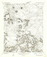
 1952 Agathla Peak1954 Print · USGSThe high desert of the Navajo Nation is captured here in the early fifties, documenting a landscape of ancient ruins and iconic monoliths. Trace historical sites like Echo Cave Ruin and Goulding Well, or locate the towering Agathla Peak and Merrick Butte.3 unique versions available
Showing maps 1-25 of 1,249
Top cities of Navajo County
- Show Low historical maps
- Winslow historical maps
- Snowflake historical maps
- Kayenta historical maps
- Holbrook historical maps
- Pinetop-Lakeside historical maps
See more
Frequently asked questions
- What are the different types of historical maps available for Navajo County?
- What is the oldest map of Navajo County?
- Where can I purchase historical maps of Navajo County for my home or office?
- Where can I download high-res historical maps of Navajo County?
- Are there historical topographic maps available for Navajo County?
- Is there historical aerial imagery available for Navajo County?
- Where are historical maps of Navajo County sourced from?