1960s Maps of Navajo County, Arizona
Explore 75 historic maps of Navajo County from the 1960s. These maps offer a rare glimpse into what life looked like during the 1960s — showing old roads, neighborhoods, homes, and landmarks that have changed or disappeared over time.
Whether you're researching your family's past, planning a metal detecting trip, or studying how Navajo County's landscape evolved across the 1960s, these high-resolution maps are a powerful tool for exploring the history of this region.
- Focus on a specific era: All maps on this page are from the 1960s, giving you a focused view of this time period.
- See what’s changed: Compare century-old streets, trails, and buildings to today's modern landscape using overlays and satellite layers.
- Research with precision: Use these maps for genealogy, historical research, land use analysis, or educational projects.
- View, download, or print: Maps are fully viewable online in high resolution, and can be downloaded or printed for your own records.
Start exploring Navajo County's history through authentic maps from the 1960s. This is your window into the past.
Navajo County, AZ maps
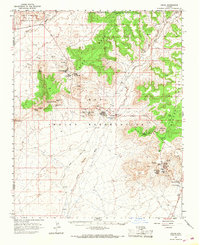
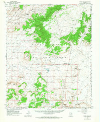
(75)- 1960 Map of Flagstaff
 1960 Flagstaff1960 Print · USGSNorthern Arizona at the dawn of the sixties shows a landscape defined by mesa-top Hopi villages and the burgeoning railroad hub of Flagstaff. Trace the path of U.S. 66 past Meteor Crater or locate historic trading posts like Gray Mountain Trading Post.2 unique versions available
 - 1960 Map of Holbrook
 1960 Holbrook1960 Print · USGSNorthern Arizona is captured here just as modern highways began to reshape the cattle and timber country of the Colorado Plateau. Genealogists and historians can trace the early footprints of Snowflake, Sedona, and Payson, alongside the Atchison Topeka & Santa Fe RR rail line.
 - 1960 Map of Escalante
 1960 Escalante1960 Print · USGSSouthern Utah and northern Arizona appear at a historic turning point in the late fifties as Lake Powell begins to reshape the canyons. Researchers can trace remote sites like Goulding Trading Post, a lonely Uranium Mine, and Coyote Ranches before the reservoir's rise.
 - 1960 Map of Mesa
 1960 Mesa1960 Print · USGSThe Salt River Valley and Superstition wilderness are captured here during a era of rapid post-war growth. Researchers can trace the mid-century footprints of Williams AF Base and Arizona State College or locate the deep-rock shafts of the Old Dominion Mine and Magma Mine.
 - 1961 Map of Marble Canyon
 1961 Marble Canyon1961 Print · USGSThe northern Arizona desert in the early sixties reveals a landscape of tribal lands and canyon crossings. Trace the old river life at Lees Ferry, find the Uranium mill at Tuba City, and locate the iconic Elephant Feet landmarks.
 - 1961 Map of Woods Canyon, 1963 Print
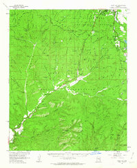
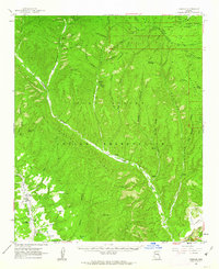
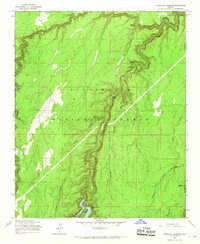
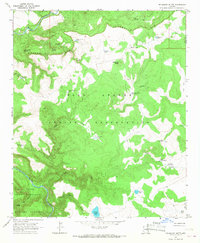
 1961 Woods Canyon1963 Print · USGSThe high plateau meets the dramatic drop of the Mogollon Rim in the early sixties, a landscape of isolated ranching and forestry. Researchers can trace historic outposts like Dutch Joe Ranch and OW Ranch or locate the Rainbow Mines.3 unique versions available
 - 1961 Map of Clay Springs, 1963 Print
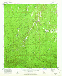
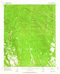
 1961 Clay Springs1963 Print · USGSThe northern Arizona rim country comes to life in this early 1960s survey, showing a landscape shaped by ranching and rugged relief. Genealogists and historians can trace old homesteads and landmarks like the Aripine P O, Flake Ranch, and the Clay Springs townsite.2 unique versions available
 - 1961 Map of Heber, 1963 Print
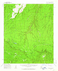
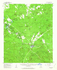
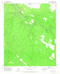
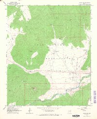
 1961 Heber1963 Print · USGSThe high timber country of Navajo County comes into focus in the early sixties as the communities of Heber and Overgaard expand. Genealogists and local historians can trace family-named sites like Bunger Ranch, the Heber Cemetery, and the Gentry Lookout station.3 unique versions available
 - 1961 Map of Show Low, 1963 Print
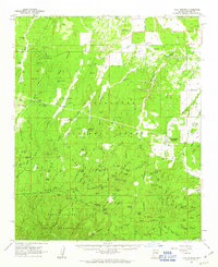
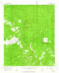
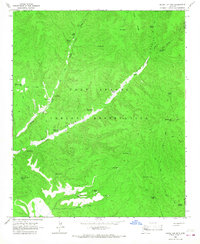
 1961 Show Low1963 Print · USGSShow Low and the northern reaches of the White Mountains are captured here in the early sixties as the region's modern infrastructure began to take shape. Researchers can trace early ranching outposts like West Ranch and find local landmarks such as the Forestdale Trading Post and Show Low Lake.2 unique versions available
 - 1961 Map of Cibecue, 1963 Print
 1961 Cibecue1963 Print · USGSThe Fort Apache Indian Reservation and Sitgreaves National Forest converge in the early sixties, showing a landscape defined by deep canyons and remote settlements. Genealogists and historians can trace the community of Cibecue, the Apache Mission School, and the local Cem.2 unique versions available
 - 1961 Map of McNary, 1963 Print
 1961 McNary1963 Print · USGSThe high country of Apache and Navajo Counties comes into focus during the early sixties, showing the vital intersection of the timber industry and emerging lakeside communities. Researchers can trace family sites near Lakeside Cem, the remote Indian Pine settlement, and several Cinder Pits along the Mogollon Rim.2 unique versions available
 - 1961 Map of Chediski Peak, 1963 Print
 1961 Chediski Peak1963 Print · USGSNavajo and Gila counties are shown here in the early 1960s, documenting the high-country landscape of the Fort Apache Indian Reservation. Genealogists and historians can trace old ranching infrastructure and remote sites like Grasshopper, Oak Creek Ranch, and the Chediski Peak Lookout.2 unique versions available
 - 1961 Map of Young, 1963 Print
 1961 Young1963 Print · USGSPleasant Valley and the high mesas of Gila County are captured here in the early sixties as cattle ranching and forestry shaped the local economy. Researchers can locate the Young settlement, Nail Ranch, and the Asbestos Mill along the rugged Cherry Creek corridor.2 unique versions available
 - 1962 Map of Flagstaff
 1962 Flagstaff1962 Print · USGSNorthern Arizona in the early sixties showcases the intersection of Tribal lands, national forests, and the busy Route 66 corridor. Trace historic roadside stops and landmarks like Meteor Crater, the Buck-Rodgers Trading Post, and the ancient village of Old Oraibi.
 - 1962 Map of Gallup
 1962 Gallup1962 Print · USGSThe high plateau and mountains surrounding Gallup in the early sixties reveal a landscape defined by tribal lands, coal mining, and the rail corridor. Researchers can locate remote trading posts, the Gibson Coal Mine, and the historic Window Rock capital.
 - 1962 Map of Clifton
 1962 Clifton1962 Print · USGSThe copper-rich Arizona-New Mexico borderlands come into focus in the early sixties, centered on the mining complexes of Morenci and Clifton. Researchers can trace the Southern Pacific rail lines and locate remote outposts like Honeymoon and the Double Circle Ranch.
 - 1962 Map of Saint Johns
 1962 Saint Johns1962 Print · USGSEastern Arizona and the New Mexico borderlands come alive in the early sixties, showing a landscape of high-plateau ranching and early national monuments. Trace the path of the Atchison Topeka and Santa Fe or locate old water sources like Salado Springs and Lyman Reservoir.
 - 1964 Map of Mesa
 1964 Mesa1964 Print · USGSCentral Arizona in the mid-1960s reveals a landscape defined by rapid desert urbanization and a massive copper mining industry. Genealogists and historians can trace the growth of Phoenix or explore the mining camps and operations at Miami Mine and Magma Mine.
 - 1965 Map of Chevelon Crossing, 1967 Print
 1965 Chevelon Crossing1967 Print · USGSCoconino County canyon country is captured in the mid-sixties, showing the rugged management of the forest plateau. Trace historic routes and livestock infrastructure through Chevelon Crossing, Mormon Crossing, and the newly formed Chevelon Canyon Lake.3 unique versions available
 - 1966 Map of Georges Butte, 1967 Print
 1966 Georges Butte1967 Print · USGSThe Black River corridor in the mid-1960s reveals a remote tribal landscape where the Fort Apache Indian Reservation meets the San Carlos Indian Reservation. Researchers can trace isolated water sources like Foreman Well and Lost Mule Tank across the Natanes Plateau.2 unique versions available
 - 1966 Map of Round Top Mtn, 1967 Print
 1966 Round Top Mtn1967 Print · USGSThe high plateau of the Fort Apache Indian Reservation is captured in the mid-1960s, showing a landscape defined by ranching and water management. Genealogists and historians can trace old cattle routes and water sources like 85 Bar Spring, G-5 Farm Tank, and Steer Pasture Spring.
 - 1966 Map of Oraibi, 1968 Print
 1966 Oraibi1968 Print · USGSThe Hopi mesas are captured in detail during the mid-1960s, showing the enduring village sites and seasonal water sources of this high desert landscape. Genealogists and historians can trace the paths between Old Oraibi, Bacabi, and ancestral locations like Po Ni Vi.2 unique versions available
 - 1966 Map of White Cone, 1968 Print
 1966 White Cone1968 Print · USGSThe high desert of northeastern Arizona is revealed here in the 1960s, showing the intersection of tribal lands and distinctive volcanic topography. Researchers can locate vital desert water sources like Sand Spring and trace the profiles of Tesihim Butte and Deshgish Butte.
 - 1966 Map of Velasquez Butte, 1968 Print
 1966 Velasquez Butte1968 Print · USGSThe high desert border between the White Mountain and San Carlos Apache lands is captured here in the mid-1960s. Researchers can trace the water-dependent ranching network across the Seven Mile Rim, locating remote sites like Tin Shack Tank No 1 and Benedict Spring.
 - 1966 Map of Canyon Day, 1968 Print
 1966 Canyon Day1968 Print · USGSThe White River valley and the Fort Apache Indian Reservation are captured here in the mid-sixties, showing a landscape of deep canyons and tribal settlements. Researchers can locate the Kinishba Ruins, trace the Old Indian School Boundary, and identify landmarks like Canyon Day and Stockman Station.
Showing maps 1-25 of 75
Top cities of Navajo County
- Show Low historical maps
- Winslow historical maps
- Snowflake historical maps
- Kayenta historical maps
- Holbrook historical maps
- Pinetop-Lakeside historical maps
See more
Frequently asked questions
- What are the different types of historical maps available for Navajo County?
- What is the oldest map of Navajo County?
- Where can I purchase historical maps of Navajo County for my home or office?
- Where can I download high-res historical maps of Navajo County?
- Are there historical topographic maps available for Navajo County?
- Is there historical aerial imagery available for Navajo County?
- Where are historical maps of Navajo County sourced from?