1950s Maps of Navajo County, Arizona
Explore 59 historic maps of Navajo County from the 1950s. These maps offer a rare glimpse into what life looked like during the 1950s — showing old roads, neighborhoods, homes, and landmarks that have changed or disappeared over time.
Whether you're researching your family's past, planning a metal detecting trip, or studying how Navajo County's landscape evolved across the 1950s, these high-resolution maps are a powerful tool for exploring the history of this region.
- Focus on a specific era: All maps on this page are from the 1950s, giving you a focused view of this time period.
- See what’s changed: Compare century-old streets, trails, and buildings to today's modern landscape using overlays and satellite layers.
- Research with precision: Use these maps for genealogy, historical research, land use analysis, or educational projects.
- View, download, or print: Maps are fully viewable online in high resolution, and can be downloaded or printed for your own records.
Start exploring Navajo County's history through authentic maps from the 1950s. This is your window into the past.
Navajo County, AZ maps
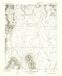
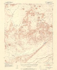
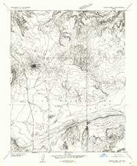
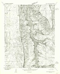
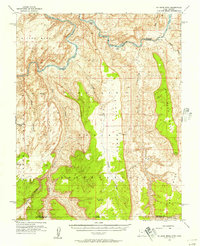
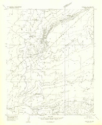
(59)- 1952 Map of Shato Spring 1 NE, 1954 Print
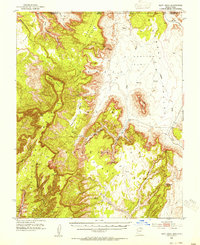
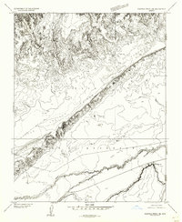
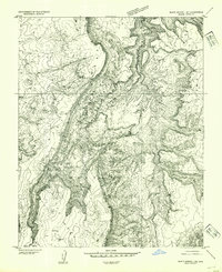 1952 Shato Spring 1 NE1954 Print · USGSThe Navajo Nation's high-country terrain is captured here in the early fifties, documenting a landscape of mesas and valleys. Researchers can trace traditional habitation sites at Hogans and find vital water sources like Shato Spring and the Sage Valley floor.
 - 1952 Map of Agathla Peak 1 NW, 1954 Print
 1952 Agathla Peak 1 NW1954 Print · USGSThe Navajo Nation's high desert landscape is captured in the early fifties, documenting a region of massive buttes and ancient archaeological sites. Researchers can locate significant landmarks like the Ruin Pueblo (Site), the House of Hands, and Mitchell Butte.
 - 1952 Map of Agathla Peak 2 SW, 1954 Print
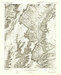 1952 Agathla Peak 2 SW1954 Print · USGSThe high plateau and deep canyon country of the Navajo Reservation are captured in the early fifties before major infrastructure arrived. Researchers can locate archaeological Ruins and trace the paths through Keet Seel Canyon and Tsegi Canyon.
 - 1952 Map of Agathla Peak 2 NW, 1954 Print
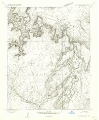
 1952 Agathla Peak 2 NW1954 Print · USGSThe high desert borderlands of the Arizona-Utah line appear in detailed relief in the early fifties, just as aerial photogrammetry was transforming western mapping. Researchers can trace the rugged topography of Skeleton Mesa and landmarks like Big Point or Todicheenie Bench.
 - 1952 Map of Boot Mesa, 1954 Print
 1952 Boot Mesa1954 Print · USGSThe Navajo Indian Reservation and Monument Valley appear here in the early fifties, before modern development reached these remote canyonlands. Researchers can locate significant archaeological sites like Keet Seel Ruin and geologic landmarks such as Boot Mesa and Hat Rock.3 unique versions available
 - 1952 Map of Agathla Peak 1 NE, 1954 Print
 1952 Agathla Peak 1 NE1954 Print · USGSThe high desert of the Navajo Nation comes to life in this mid-century survey of the iconic borderlands. Geologists and historians can trace the intricate terrain around Echo Cave Ruin and landmark spires like West Mitten Butte and the Totem Pole.
 - 1952 Map of Clay Hills 3 SW, 1954 Print
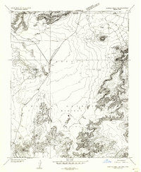
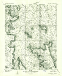 1952 Clay Hills 3 SW1954 Print · USGSThe high desert borderlands of San Juan County and the Navajo Nation are meticulously captured in the early 1950s. Researchers can trace the winding Trail through Copper Canyon and locate landmarks like Jacobs Monument and Hoskinnini Mesa.
 - 1952 Map of Agathla Peak 2 SE, 1954 Print
 1952 Agathla Peak 2 SE1954 Print · USGSThe northern Arizona plateau appears here during the early 1950s, showing the high Tyende Mesa and the wide Navajo Indian Reservation. Researchers can trace a historic Wagon Trail and find remote landmarks like a solitary windmill and Half Dome.
 - 1952 Map of Agathla Peak 1 SE, 1954 Print
 1952 Agathla Peak 1 SE1954 Print · USGSNortheastern Arizona and the high desert of the Navajo Nation are captured here in the early fifties. Local researchers can trace the course of Laguna Creek past Baby Rocks and across the Navajo Co and Apache Co line.
 - 1952 Map of Agathla Peak 2 NE, 1954 Print
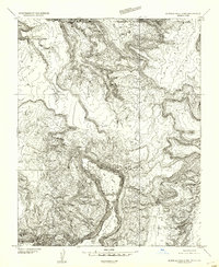
 1952 Agathla Peak 2 NE1954 Print · USGSThe Navajo borderlands of Arizona and Utah are captured here in the early 1950s, showing a landscape defined by deep washes and high-desert flats. Researchers can locate the Hogan Church and trace the paths of Olieto Wash and El Capitan Wash across Capitan Flat.
 - 1952 Map of Agathla Peak, 1954 Print
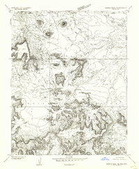
 1952 Agathla Peak1954 Print · USGSThe high desert of the Navajo Nation is captured here in the early fifties, documenting a landscape of ancient ruins and iconic monoliths. Trace historical sites like Echo Cave Ruin and Goulding Well, or locate the towering Agathla Peak and Merrick Butte.3 unique versions available
 - 1952 Map of Agathla Peak 1 SW, 1954 Print
 1952 Agathla Peak 1 SW1954 Print · USGSThe Navajo Nation high country is captured here in the early 1950s, showing a landscape shaped by volcanic geology and traditional land use. Researchers can trace landforms like Agathla Peak (El Capitan), Chaistla Butte, and the striking Porras Dikes.
 - 1952 Map of Navajo Mtn. 4 SE, 1955 Print
 1952 Navajo Mtn. 4 SE1955 Print · USGSThe borderlands of Utah and Arizona are captured here in the early 1950s, revealing a landscape of traditional settlement and deep canyons. Researchers can trace the Wetherill Trail past remote Hogans and prominent landmarks like Thumb Rock.
 - 1952 Map of Oljeto, 1957 Print
 1952 Oljeto1957 Print · USGSThe borderlands of Utah and Arizona are captured here in the early fifties, documenting a remote stretch of the Navajo Reservation. Trace the reach of high-desert landmarks like Whirlwind Mine, the settlement at Oljeto, and the distinctive Organ Rock.2 unique versions available
 - 1953 Map of Navajo Mountain 4 SW, 1954 Print
 1953 Navajo Mountain 4 SW1954 Print · USGSThe high desert borderlands of Utah and Arizona are captured here in the mid-fifties, just as modern aerial mapping reached the Navajo Indian Reservation. Researchers can trace the steep contours of the Plateau and the rugged expanse of Rainbow across the San Juan and Navajo County lines.
 - 1953 Map of Navajo Mountain, 1956 Print
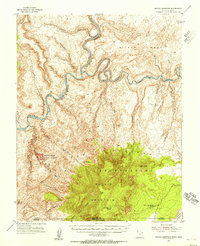 1953 Navajo Mountain1956 Print · USGSThe high desert and river canyons of the Utah-Arizona border are shown here in the early 1950s, before the landscape was altered by major dams. Researchers can trace remote trails leading to Rainbow Bridge National Monument, the Navajo Mountain Sch, and War God Spring.3 unique versions available
 - 1953 Map of No Mans Mesa, 1957 Print
 1953 No Mans Mesa1957 Print · USGSThe Navajo Indian Reservation border along the San Juan River appears in the early 1950s, a period of remote wilderness and high-desert outposts. Researchers can trace the Wetherill Trail as it winds past Spencer Camp and the massive No Mans Mesa.3 unique versions available
 - 1954 Map of Winslow, 1956 Print
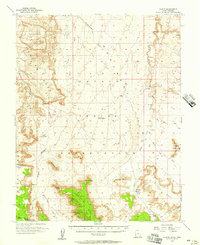
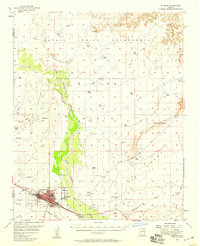 1954 Winslow1956 Print · USGSIn the mid-fifties, Winslow thrived as a vital rail and aviation crossroads along the Little Colorado River. Researchers can trace the layout of Winslow and Bushman Acres, the facilities at Winslow Municipal Airport, and the Atchison Topeka and Santa Fe tracks.2 unique versions available
 - 1954 Map of Winslow 4 NW, 1957 Print
 1954 Winslow 4 NW1957 Print · USGSNavajo County and the northern Coconino border are seen here in the mid-1950s, centered on the Little Colorado River. Researchers can trace old stock routes and water sources across the Navajo Indian Reservation to Tucker Flat.
 - 1954 Map of Winslow 4 SW, 1957 Print
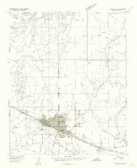 1954 Winslow 4 SW1957 Print · USGSThe railroad town of Winslow is captured in the mid-fifties as a bustling Route 66 hub. Researchers can trace family-named sites, early aviation at the Winslow Municipal Airport, and local landmarks like the Drive-in Theater.
 - 1954 Map of Winslow 4 SE, 1957 Print
 1954 Winslow 4 SE1957 Print · USGSNavajo County's high desert landscape comes into focus during the mid-fifties, showing the vital water and transport networks of the era. Genealogists and historians can trace the Winslow-Polacca Road past Rincon Ranch and the settlement at Edge.
 - 1954 Map of Winslow 4 NE, 1957 Print
 1954 Winslow 4 NE1957 Print · USGSNavajo County and the northern desert reaches are captured here in the mid-fifties, showing the intersection of ranching life and indigenous lands. Researchers can trace the old Winslow-Polacca Road past the isolated Hogan and numerous Stock Tanks.
 - 1954 Map of Flagstaff, 1966 Print
 1954 Flagstaff1966 Print · USGSNorthern Arizona in the mid-fifties shows a landscape of volcanic peaks and ancestral mesa villages linked by the iconic U.S. 66. Trace the path of the Atchison Topeka and Santa Fe through Winslow or explore the settlements of Old Oraibi and Kearns Canyon.3 unique versions available
 - 1954 Map of Holbrook, 1966 Print
 1954 Holbrook1966 Print · USGSNorth-central Arizona is seen here during the mid-fifties, from the high plateau of the Mogollon Rim to the Verde Valley. Researchers can trace the early growth of Holbrook, locate remote camps like Happy Jack, and explore the roads around Montezuma Castle National Monument.3 unique versions available
 - 1954 Map of Clifton, 1968 Print
 1954 Clifton1968 Print · USGSThe high timber and copper country of the Arizona-New Mexico border is captured here during the mid-fifties. Genealogists and historians can trace family holdings like the Double Circle Ranch or study the industrial footprint of the Smelting Plant at Clifton.3 unique versions available
Showing maps 1-25 of 59
Top cities of Navajo County
- Show Low historical maps
- Winslow historical maps
- Snowflake historical maps
- Kayenta historical maps
- Holbrook historical maps
- Pinetop-Lakeside historical maps
See more
Frequently asked questions
- What are the different types of historical maps available for Navajo County?
- What is the oldest map of Navajo County?
- Where can I purchase historical maps of Navajo County for my home or office?
- Where can I download high-res historical maps of Navajo County?
- Are there historical topographic maps available for Navajo County?
- Is there historical aerial imagery available for Navajo County?
- Where are historical maps of Navajo County sourced from?