
1953 Map of No Mans Mesa
USGS Topo · Published 1957About this map
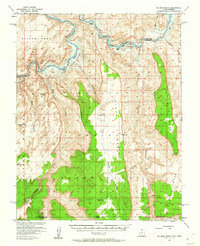
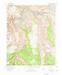
The San Juan River carves a dramatic path through the high desert of the Navajo Indian Reservation, defining the northern border of this remote landscape. In the early 1950s, this area was largely characterized by its vertical topography and isolated outposts. To the north, Wilson Mesa overlooks the river bend, while the massive plateau of No Mans Mesa dominates the eastern half of the survey. The landscape is deeply incised by drainages like Piute Canyon and Nakaicanyon, which serve as natural corridors through the steep cliffs.
Find a feature on this map
29 named features on this map. Tap any name to fly to it.
Don’t see what you’re looking for? This feature index may not catch every label — zoom into the map to look around manually.
Map Details
Editions of this 1953 No Mans Mesa Map
3 editions found
Other maps of this area

1883 · Marsh Pass
USGS Topo · 1:250,000

1886 · Henry Mountains
USGS Topo · 1:250,000

1892 · Marsh Pass
USGS Topo · 1:250,000

1892 · Henry Mountains
USGS Topo · 1:250,000

1952 · Shato Spring 1 NE
USGS Topo · 1:24,000

1952 · Agathla Peak 2 NW
USGS Topo · 1:24,000

1952 · Boot Mesa
USGS Topo · 1:62,500

1952 · Clay Hills 3 SW
USGS Topo · 1:24,000

1952 · Clay Hills 3 NW
USGS Topo · 1:24,000

1952 · Navajo Mtn. 4 SE
USGS Topo · 1:24,000