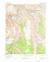
1953 Map of No Mans Mesa
USGS Topo · Published 1975About this map
San Juan River canyons dominate this mid-century landscape, surveyed as the region prepared for the waters of Lake Powell. The map illustrates a transitional moment in the Utah-Arizona borderlands, where established outposts like Spencer Camp and Zahn Camp sit along the riverbanks destined for inundation. To the south, the vast Navajo Indian Reservation covers the territory, marked by traditional trails and remote landmarks. The rugged topography of the Rainbow Plateau is punctuated by geological features such as Hawkeye Natural Bridge and Thumb Rock. Transportation in this era relied on historic paths like the Wetherill Trail, which winds through the complex drainage systems of Piute Canyon and Nokai Canyon. The survey, completed with cooperation from the Atomic Energy Commission, provides a detailed view of the high mesas including No Mans Mesa and Nokai Mesa before modern developments reached this corner of the San Juan basin.
Find a feature on this map
25 named features on this map. Tap any name to fly to it.
Don’t see what you’re looking for? This feature index may not catch every label — zoom into the map to look around manually.
Map Details
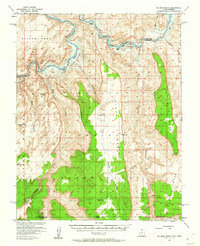
Editions of this 1953 No Mans Mesa Map
3 editions found

Other maps of this area

1883 · Marsh Pass
USGS Topo · 1:250,000

1886 · Henry Mountains
USGS Topo · 1:250,000

1892 · Marsh Pass
USGS Topo · 1:250,000

1892 · Henry Mountains
USGS Topo · 1:250,000

1952 · Shato Spring 1 NE
USGS Topo · 1:24,000

1952 · Agathla Peak 2 NW
USGS Topo · 1:24,000

1952 · Boot Mesa
USGS Topo · 1:62,500

1952 · Clay Hills 3 SW
USGS Topo · 1:24,000

1952 · Clay Hills 3 NW
USGS Topo · 1:24,000

1952 · Navajo Mtn. 4 SE
USGS Topo · 1:24,000