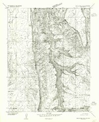
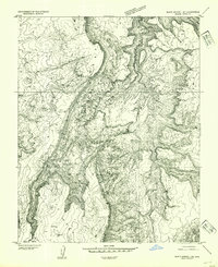
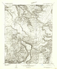
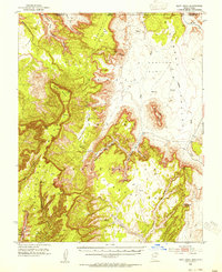
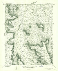
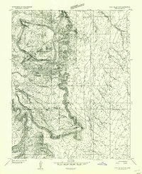
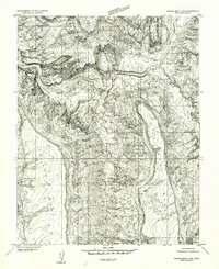
1952 Map of Navajo Mtn. 4 SE
USGS Topo · Published 1955About this map
Navajo Indian Reservation lands dominate this mid-century topographic study, which straddles the high desert border between Utah and Arizona. The landscape is defined by the deep incision of Nokai Canyon and the massive uplift of Mans Mesa, reflecting the complex erosion patterns of the Colorado Plateau. Scattered dwellings, marked simply as Hogan or Hogans, appear across the western flats and near the base of prominent landmarks like Thumb Rock. These traditional structures, clustered primarily along the drainage of Neska Wash, suggest a landscape where seasonal grazing and ancestral living patterns dictated settlement. Connectivity across this demanding terrain is limited to the historic Wetherill Trail, which snakes across the central mesas, providing a rare transit route through the labyrinthine canyon system before the advent of modern road infrastructure in the region.
Find a feature on this map
14 named features on this map. Tap any name to fly to it.
Don’t see what you’re looking for? This feature index may not catch every label — zoom into the map to look around manually.
Map Details
Editions of this 1952 Navajo Mtn. 4 SE Map
This is the sole edition of this map. No revisions or reprints were ever made.
Other maps of this area

1883 · Marsh Pass
USGS Topo · 1:250,000

1886 · Henry Mountains
USGS Topo · 1:250,000

1892 · Marsh Pass
USGS Topo · 1:250,000

1892 · Henry Mountains
USGS Topo · 1:250,000
1952 · Shato Spring 1 NE
USGS Topo · 1:24,000
1952 · Agathla Peak 2 NW
USGS Topo · 1:24,000
1952 · Boot Mesa
USGS Topo · 1:62,500
1952 · Clay Hills 3 SW
USGS Topo · 1:24,000
1952 · Clay Hills 3 NW
USGS Topo · 1:24,000
1952 · Navajo Mountain 4 NE
USGS Topo · 1:24,000