
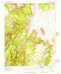
1952 Map of Boot Mesa
USGS Topo · Published 1954About this map
Navajo Indian Reservation lands dominate this mid-century survey, revealing a landscape where ancient habitation and vast geologic formations intersect at the Arizona-Utah border. The eastern portion of the map showcases the distinctive topography of Monument Valley, including Boot Mesa and the spire of Hat Rock. Archaeological significance is central to this sheet, which identifies the Navajo National Monument boundary and provides precise locations for the Betatakin Ruin and Keet Seel Ruin, along with numerous other unnamed Cliff Dwellings tucked into the deep sandstone drainages of Skeleton Mesa. The terrain is characterized by massive plateau systems like Hoskinnini Mesa and Naka I Mesa, separated by complex canyon networks including Copper Canyon and Dowozhiebito Canyon. Natural water sources such as Parrish Creek and various Spring points are marked, alongside modern additions like a Windmill and scattered livestock Ponds on the El Capitan Flat.
Find a feature on this map
42 named features on this map. Tap any name to fly to it.
Don’t see what you’re looking for? This feature index may not catch every label — zoom into the map to look around manually.
Map Details
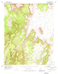
Editions of this 1952 Boot Mesa Map
3 editions found
Other maps of this area

1883 · Marsh Pass
USGS Topo · 1:250,000

1886 · Henry Mountains
USGS Topo · 1:250,000

1892 · Marsh Pass
USGS Topo · 1:250,000

1892 · Henry Mountains
USGS Topo · 1:250,000

1952 · Clay Hills 4 SW
USGS Topo · 1:24,000

1952 · Clay Hills 3 SE
USGS Topo · 1:24,000

1952 · Shato Spring 1 NE
USGS Topo · 1:24,000

1952 · Agathla Peak 1 NW
USGS Topo · 1:24,000

1952 · Agathla Peak 2 SW
USGS Topo · 1:24,000

1952 · Agathla Peak 2 NW
USGS Topo · 1:24,000