Old Maps of Show Low, Arizona
Explore 41 old maps of Show Low, spanning from 1886 to today. These high-resolution historic maps reveal how streets, neighborhoods, landmarks, and natural features evolved over time — perfect for genealogy, metal detecting, research, and local history exploration.
What you can do with these maps:
- See how Show Low changed over time: Compare historical maps to modern-day views to trace roads, homesites, rail lines & more.
- View detailed metadata: Each map includes creators, publishers, year, scale, and archive source.
- Overlay maps with satellite & LiDAR: Visualize the past alongside modern tools to explore terrain & human change.
- Trusted historical sources: Maps sourced from the USGS, Library of Congress, and other archives.
- Access maps your way: View online, download high-res files, or order prints for personal or research use.
Start exploring old maps of Show Low to uncover forgotten places, hidden landmarks, and the deep history beneath your feet.
Show Low, AZ maps
(41)- 1886 Map of St Johns
 1886 St Johns1886 Print · USGSApache County in the 1880s was a landscape of emerging pioneer outposts and high-plateau cattle ranching. Researchers can trace the early footprints of settlements like St Johns and Erastus or locate the original path of the Atlantic and Pacific Railroad.
 - 1886 Map of Holbrook
 1886 Holbrook1886 Print · USGSArizona's high desert and the Mogollon Rim frontier are captured here in the late nineteenth century during the height of early pioneer settlement. Trace the growth of river towns like Holbrook and Snowflake or locate remote outposts such as Wilford, Adair, and Heber.
 - 1892 Map of St Johns
 1892 St Johns1892 Print · USGSArizona's eastern frontier is documented here in the late nineteenth century as cattle ranching and early settlements followed the path of the river. Genealogists and historians can trace the foundations of St Johns and Springerville or locate long-standing sites like Erastus and Windmill Ranch.5 unique versions available
 - 1893 Map of Holbrook
 1893 Holbrook1893 Print · USGSNortheastern Arizona in the 1880s reveals a landscape of nascent ranching towns and deep canyon systems along the high plateau. Genealogists and historians can trace the early footprints of Holbrook, Snowflake, and Showlow as they appeared before the turn of the century.4 unique versions available
 - 1954 Map of Holbrook, 1966 Print
 1954 Holbrook1966 Print · USGSNorth-central Arizona is seen here during the mid-fifties, from the high plateau of the Mogollon Rim to the Verde Valley. Researchers can trace the early growth of Holbrook, locate remote camps like Happy Jack, and explore the roads around Montezuma Castle National Monument.3 unique versions available
 - 1954 Map of Saint Johns, 1968 Print
 1954 Saint Johns1968 Print · USGSThe high plateau of the Arizona-New Mexico border is captured here in the mid-1950s, showing the intersection of tribal lands and national forests. Researchers can trace the cattle country and mountain outposts from Saint Johns to Pie Town and McNary.3 unique versions available
 - 1957 Map of Holbrook
 1957 Holbrook1957 Print · USGSNorthern Arizona in the mid-fifties is defined by the high-plateau timberlands and the bustling rail corridor of the Little Colorado River valley. Genealogists and historians can trace the route of U.S. 66 through Holbrook or locate more remote outposts like Zeniff and Aripine.
 - 1957 Map of Saint Johns
 1957 Saint Johns1957 Print · USGSThe Arizona-New Mexico borderlands are captured here in the mid-fifties, showing the high-country settlements and federal lands before modern development. Genealogists and historians can trace old homesteads and landmarks like the Red Hill Post Office, Lyman Reservoir, and the mountain communities of Eagar and Springerville.
 - 1958 Map of Saint Johns
 1958 Saint Johns1958 Print · USGSEastern Arizona and western New Mexico appear here in the late fifties, showcasing the high plateau and forest landscapes along the Continental Divide. Researchers can trace early ranching routes and water systems like Lyman Reservoir or locate remote settlements such as Fence Lake and Atarque.2 unique versions available
 - 1958 Map of Holbrook
 1958 Holbrook1958 Print · USGSNortheastern Arizona's high country is captured here during the mid-fifties, showing the growth of mountain towns and timber lands. Researchers can trace the Atchison Topeka & Santa Fe RR through Holbrook or find vanished spots like Zeniff.
 - 1960 Map of Holbrook
 1960 Holbrook1960 Print · USGSNorthern Arizona is captured here just as modern highways began to reshape the cattle and timber country of the Colorado Plateau. Genealogists and historians can trace the early footprints of Snowflake, Sedona, and Payson, alongside the Atchison Topeka & Santa Fe RR rail line.
 - 1961 Map of Show Low, 1963 Print
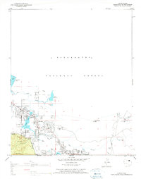
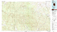
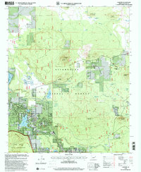
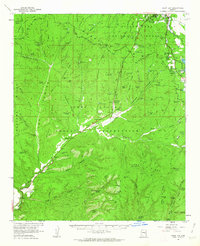 1961 Show Low1963 Print · USGSShow Low and the northern reaches of the White Mountains are captured here in the early sixties as the region's modern infrastructure began to take shape. Researchers can trace early ranching outposts like West Ranch and find local landmarks such as the Forestdale Trading Post and Show Low Lake.2 unique versions available
 - 1961 Map of McNary, 1963 Print
 1961 McNary1963 Print · USGSThe high country of Apache and Navajo Counties comes into focus during the early sixties, showing the vital intersection of the timber industry and emerging lakeside communities. Researchers can trace family sites near Lakeside Cem, the remote Indian Pine settlement, and several Cinder Pits along the Mogollon Rim.2 unique versions available
 - 1962 Map of Saint Johns
 1962 Saint Johns1962 Print · USGSEastern Arizona and the New Mexico borderlands come alive in the early sixties, showing a landscape of high-plateau ranching and early national monuments. Trace the path of the Atchison Topeka and Santa Fe or locate old water sources like Salado Springs and Lyman Reservoir.
 - 1970 Map of Show Low North, 1973 Print
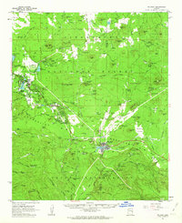
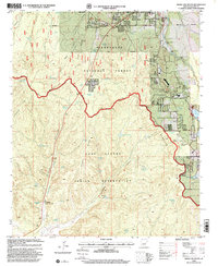
 1970 Show Low North1973 Print · USGSShow Low and the surrounding high-country forests are documented here as the town expanded into a recreational and utility hub. Genealogists and historians can trace the early layout of Show Low, from the Cem and Rodeo Grounds to infrastructure like the Lone Pine Dam.2 unique versions available
 - 1971 Map of Silver Springs, 1973 Print
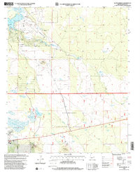
 1971 Silver Springs1973 Print · USGSNavajo County's high plateau during the early seventies is defined by its vital water systems and forestry boundaries. Trace local infrastructure from the Silver Springs Fish Hatchery and White Mountain Lake to the Show Low Municipal Airport and regional Cinder Pits.3 unique versions available
 - 1976 Map of Lakeside, 1977 Print
 1976 Lakeside1977 Print · USGSHigh on the Arizona plateau in the 1970s, the communities of Lakeside and Pinetop thrive alongside the Mogollon Rim. Local historians can trace family-named sites like Adair Spring and landmarks like the Springer Mtn Lookout.2 unique versions available
 - 1977 Map of Show Low South, 1978 Print
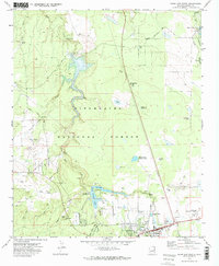
 1977 Show Low South1978 Print · USGSThe Mogollon Rim country in the late seventies shows the southern growth of Show Low as it pushes toward the reservation line. Researchers can trace historic outposts like the Forestdale Trading Post or find unnamed Ruins tucked in Forestdale Canyon.2 unique versions available
 - 1977 Map of Lakeside, 1978 Print
 1977 Lakeside1978 Print · USGSNavajo County's high-plateau communities are captured here in the late seventies as they grew along the Mogollon Rim. Local historians can trace family-named landmarks and water sources like Rainbow Lake, Adair Spring, and the Cem near the lakeside settlements.
 - 1981 Map of Springerville, 1982 Print
 1981 Springerville1982 Print · USGSThe high-country settlements of eastern Arizona come into focus during the early eighties, from the timber towns of Lakeside and Pinetop to the ranching center of Springerville. Trace family roots in McNary and Eagar or locate historic landmarks like the Williams Creek National Fish Hatchery.2 unique versions available
 - 1981 Map of Show Low, 1982 Print
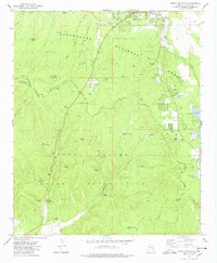
 1981 Show Low1982 Print · USGSThe Mogollon Rim highlands in the early eighties were a landscape of forest service outposts and remote reservation settlements. Local historians can trace the foundations of Show Low and Snowflake, or locate family sites near Cibecue and Heber.2 unique versions available
 - 1998 Map of Show Low South, 2000 Print
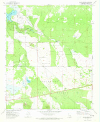
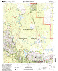
 1998 Show Low South2000 Print · USGSNavajo County's high-altitude forest and tribal lands meet at the edge of the Mogollon Rim during the late 1990s. Researchers can trace the layout of the Forestdale Trading Post, locate the NPC Campus, and explore the canyon drainages of Forestdale Creek.
 - 1998 Map of Show Low North, 2000 Print
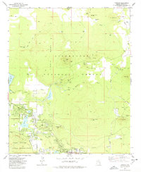
 1998 Show Low North2000 Print · USGSIn the late nineties, Show Low was expanding its footprint within the Sitgreaves National Forest. Researchers can trace local development through the Show Low Municipal Airport, neighborhood landmarks like the Rodeo Grounds, and numerous water features including Fools Hollow Lake and Long Lake.
 - 1998 Map of Silver Springs, 2000 Print
 1998 Silver Springs2000 Print · USGSNavajo County and the Sitgreaves National Forest are shown here in the late nineties as a blend of forest management and growing aviation infrastructure. Researchers can locate family landmarks like Cooley Knoll or trace water resources at the Fish Hatchery and Silver Springs.
 - 1998 Map of Lakeside, 2001 Print
 1998 Lakeside2001 Print · USGSLakeside and Pinetop are shown at the end of the twentieth century as they developed along the edge of the Apache Indian Reservation. Trace the local water and rail network through Rainbow Lake, the Sponseller Siding, and Porter Spring.
Showing maps 1-25 of 41
Top cities near Show Low
Frequently asked questions
- What are the different types of historical maps available for Show Low?
- What is the oldest map of Show Low?
- Where can I purchase historical maps of Show Low for my home or office?
- Where can I download high-res historical maps of Show Low?
- Are there historical topographic maps available for Show Low?
- Is there historical aerial imagery available for Show Low?
- Where are historical maps of Show Low sourced from?