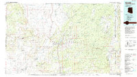
1980s Maps of Navajo County, Arizona
Explore 46 historic maps of Navajo County from the 1980s. These maps offer a rare glimpse into what life looked like during the 1980s — showing old roads, neighborhoods, homes, and landmarks that have changed or disappeared over time.
Whether you're researching your family's past, planning a metal detecting trip, or studying how Navajo County's landscape evolved across the 1980s, these high-resolution maps are a powerful tool for exploring the history of this region.
- Focus on a specific era: All maps on this page are from the 1980s, giving you a focused view of this time period.
- See what’s changed: Compare century-old streets, trails, and buildings to today's modern landscape using overlays and satellite layers.
- Research with precision: Use these maps for genealogy, historical research, land use analysis, or educational projects.
- View, download, or print: Maps are fully viewable online in high resolution, and can be downloaded or printed for your own records.
Start exploring Navajo County's history through authentic maps from the 1980s. This is your window into the past.
Navajo County, AZ maps
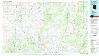
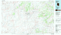
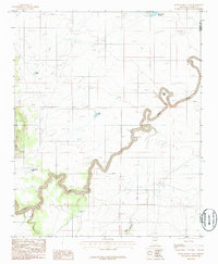
(46)- 1980 Map of Holbrook, 1996 Print
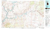
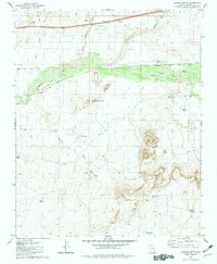
 1980 Holbrook1996 Print · USGSHolbrook and the surrounding Navajo County high desert are captured here in the early eighties, showcasing a landscape of rail-driven commerce and ranching. Researchers can trace the Atchison Topeka and Santa Fe RR through Penzance or locate historical points like Mormon Crossing and Rock Station.2 unique versions available
 - 1981 Map of Navajo Mountain, 1982 Print
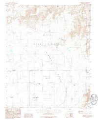
 1981 Navajo Mountain1982 Print · USGSThe high desert border of Utah and Arizona is captured here in the early eighties, showing the sprawling waters of Lake Powell and the San Juan River. Researchers can locate the Sunwind Mine, the Navajo Mountain School, and the iconic Rainbow Bridge.
 - 1981 Map of Springerville, 1982 Print
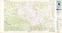 1981 Springerville1982 Print · USGSThe high-country settlements of eastern Arizona come into focus during the early eighties, from the timber towns of Lakeside and Pinetop to the ranching center of Springerville. Trace family roots in McNary and Eagar or locate historic landmarks like the Williams Creek National Fish Hatchery.2 unique versions available
 - 1981 Map of Show Low, 1982 Print
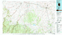
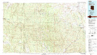 1981 Show Low1982 Print · USGSThe Mogollon Rim highlands in the early eighties were a landscape of forest service outposts and remote reservation settlements. Local historians can trace the foundations of Show Low and Snowflake, or locate family sites near Cibecue and Heber.2 unique versions available
 - 1981 Map of Saint Johns, 1996 Print
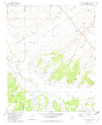
 1981 Saint Johns1996 Print · USGSNortheastern Arizona's high plateau comes into focus in the early 1980s, centered on the settlement of St Johns. Researchers can trace the Atchison Topeka and Santa Fe railroad through Adamana and locate landmarks like Lyman Lake and Zion Reservoir.
 - 1981 Map of Nutrioso, 1996 Print
 1981 Nutrioso1996 Print · USGSEastern Arizona and the New Mexico borderlands are captured here in the early eighties, showcasing a vast expanse of national forest and tribal lands. Researchers can trace the high-country routes between Nutrioso, Alpine, and Whiteriver, or locate landmarks along the Mogollon Rim and Black River.2 unique versions available
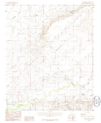
 - 1982 Map of Manuel Seep
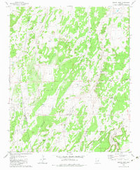 1982 Manuel Seep1982 Print · USGSThe high plateau of Apache County is captured here in the early eighties, showing a landscape defined by seasonal washes and cattle ranching. Researchers can locate remote water improvements such as Manuel Seep, the East Windmill, and Stink Seep No 1.2 unique versions available
 - 1982 Map of Padilla Tank, 1983 Print
 1982 Padilla Tank1983 Print · USGSNavajo County in the early eighties shows a landscape of ranching waterworks and the protected lands of the Petrified Forest National Park. Researchers can trace the water-management history of the high desert through Padilla Tank and Broken Dam Tank.
 - 1982 Map of Adamana, 1983 Print
 1982 Adamana1983 Print · USGSNortheastern Arizona's high desert is captured here in the early eighties, showing where the transcontinental railroad meets the ancient archaeology of the Painted Desert. Researchers can locate the settlement of Adamana alongside Puerco Indian Ruins and landmarks like Newspaper Rock.
 - 1982 Map of Polacca, 1983 Print
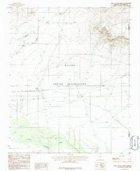
 1982 Polacca1983 Print · USGSTraditional villages on the high mesas of the Colorado Plateau are documented here during the early eighties. Genealogists and historians can locate ancient settlements like Old Oraibi and Walpi, or trace water sources such as Bluebird Spring and Sunlight Mission.2 unique versions available
 - 1982 Map of Little Milky Wash, 1983 Print
 1982 Little Milky Wash1983 Print · USGSThe high desert of eastern Arizona is captured here in the early 1980s, documenting a landscape defined by ranching and ancient history. Researchers can locate remote archaeological Ruins, trace the winding Little Colorado River, and find family-named landmarks like Jeff Lake and Cheney Flat.
 - 1982 Map of Sanders, 1983 Print
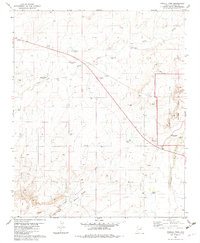
 1982 Sanders1983 Print · USGSThe high desert of Apache County is captured here in the early eighties, showcasing the intersection of tribal lands and major transit corridors. Researchers can trace the path of the Atchison Topeka and Santa Fe and find remote outposts like Sanders, Houck, and Crows Nest Windmill.
 - 1982 Map of Agate House, 1983 Print
 1982 Agate House1983 Print · USGSThe high desert of Apache County is captured here in the early eighties, centered on the unique archaeology of the Petrified Forest National Park. Researchers can locate Agate House (Ruins), Petroglyphs, and livestock landmarks like Lorin Farr Tank.
 - 1982 Map of Carrizo Butte, 1983 Print
 1982 Carrizo Butte1983 Print · USGSThe high desert of Navajo County comes into focus in the early 1980s, centered on the vital rail corridor and rugged geology of the Puerco River valley. Researchers can trace ranching history and early rail alignments through Ortegas Ranch, Goodwater, and the Ramsey Slide.
 - 1982 Map of Winslow, 1983 Print
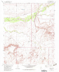
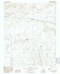
 1982 Winslow1983 Print · USGSThe High Desert of Northern Arizona in the early eighties shows the intersection of tribal lands and railroad history. Genealogists and historians can locate remote settlements like Leupp and Indian Wells or trace the Atchison Topeka and Santa Fe line past Bushman Acres.2 unique versions available
 - 1983 Map of Pinon
 1983 Pinon1983 Print · USGSThe Navajo and Hopi heartlands are shown in detail during the early eighties, capturing the intricate topography of the high mesas. Researchers can locate remote settlements like Pinon and Red Lake, while tracing ancient landmarks such as White Mesa and numerous Ruin sites.2 unique versions available
 - 1984 Map of Kayenta
 1984 Kayenta1984 Print · USGSThe Navajo Nation in the mid-1980s reveals a landscape of massive sandstone mesas and ancient monuments. Researchers can trace the development of Kayenta and find landmarks like Yellow Water Mine, Goulding Well, and the Navajo National Monument.
 - 1984 Map of Ganado
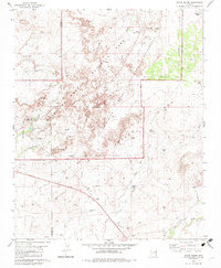
 1984 Ganado1984 Print · USGSThe Navajo Nation in the mid-eighties reveals a landscape of high mesas and vital community hubs across Apache County. Trace the development of Fort Defiance and Window Rock, or locate historic landmarks like Hubbell Trading Post and Kinlichee Boarding School.2 unique versions available
 - 1986 Map of Pump Ranch Tank
 1986 Pump Ranch Tank1986 Print · USGSCoconino County ranch lands are detailed in the mid-1980s, showing the intersection of water management and topography. Researchers can locate remote cattle infrastructure such as Pump Ranch Tank and Relic Point or trace the winding path of Clear Creek.
 - 1986 Map of Rincon Ranch
 1986 Rincon Ranch1986 Print · USGSNavajo County ranching country is documented here in the mid-1980s, showcasing the remote desert uplands and essential water sources of the region. Researchers can locate specific sites like Rincon Ranch, Homestead Spring, and the seasonal drainage of Cottonwood Wash.
 - 1986 Map of Joseph City
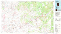
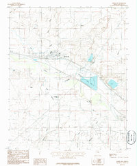 1986 Joseph City1986 Print · USGSNavajo County ranching and rail infrastructure are on full display in the mid-1980s as Joseph City sits at the intersection of desert life and industry. Trace the historic route of the Atchison Topeka and Santa Fe and the water networks of Cholla Lake and Hashknife Tank.
 - 1986 Map of Winslow NE
 1986 Winslow NE1986 Print · USGSThe Navajo Indian Reservation in the mid-1980s reveals a ranching landscape centered on the wide Rincon Basin. Researchers can trace essential water sources and livestock markers like Old Corral Tank, Big Tank, and the lone Corral.
 - 1986 Map of East of Old Leupp
 1986 East of Old Leupp1986 Print · USGSThe Navajo Indian Reservation and the Little Colorado River meet in this mid-eighties desert survey. Researchers can trace the path of Corn Creek or locate isolated infrastructure like the Pumping Sta and the Landing Strip.
 - 1986 Map of Apache Butte
 1986 Apache Butte1986 Print · USGSThe high-desert terrain of Navajo County in the mid-1980s is defined here by the winding Little Colorado River. Genealogists and researchers can locate the settlement of Jackrabbit and trace livestock water sources like Mc Donald Spring and Stratton Tank.
 - 1986 Map of Winslow
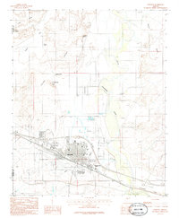 1986 Winslow1986 Print · USGSWinslow is shown during the mid-1980s as a thriving rail and regional center along the Little Colorado River. Genealogists and researchers can trace the city's growth around the Atchison Topeka and Santa Fe railroad and the Northland Pioneer College campus.
Showing maps 1-25 of 46
Top cities of Navajo County
- Show Low historical maps
- Winslow historical maps
- Snowflake historical maps
- Kayenta historical maps
- Holbrook historical maps
- Pinetop-Lakeside historical maps
See more
Frequently asked questions
- What are the different types of historical maps available for Navajo County?
- What is the oldest map of Navajo County?
- Where can I purchase historical maps of Navajo County for my home or office?
- Where can I download high-res historical maps of Navajo County?
- Are there historical topographic maps available for Navajo County?
- Is there historical aerial imagery available for Navajo County?
- Where are historical maps of Navajo County sourced from?