2024 Map of Dixie
USGS Topo · Published 2024About this map
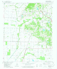
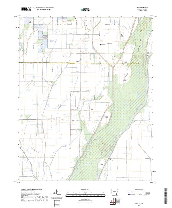
The Saint Francis River winds through the eastern portion of this Arkansas landscape, creating a complex network of wetlands and river islands. The terrain is characterized by its agricultural drainage and low-lying topography, featuring prominent named landmasses like Newton Island, Big Island, and Cane Island. These islands are flanked by significant drainage projects such as Big Bay Ditch and Eightmile Ditch, which represent the extensive efforts to manage the water levels in this corner of the Mississippi Delta. Small rural settlements and crossroads anchor the region, including Dixie, Miller, and Schug, reflecting a dispersed community structure typical of the state's northeastern river basins.
Find a feature on this map
84 named features on this map. Tap any name to fly to it.
Don’t see what you’re looking for? This feature index may not catch every label — zoom into the map to look around manually.
Map Details
Editions of this 2024 Dixie Map
This is the sole edition of this map. No revisions or reprints were ever made.
Historical Maps of Miller Through Time
8 maps found