2024 Map of Dodson
USGS Topo · Published 2024About this map
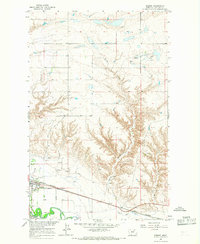
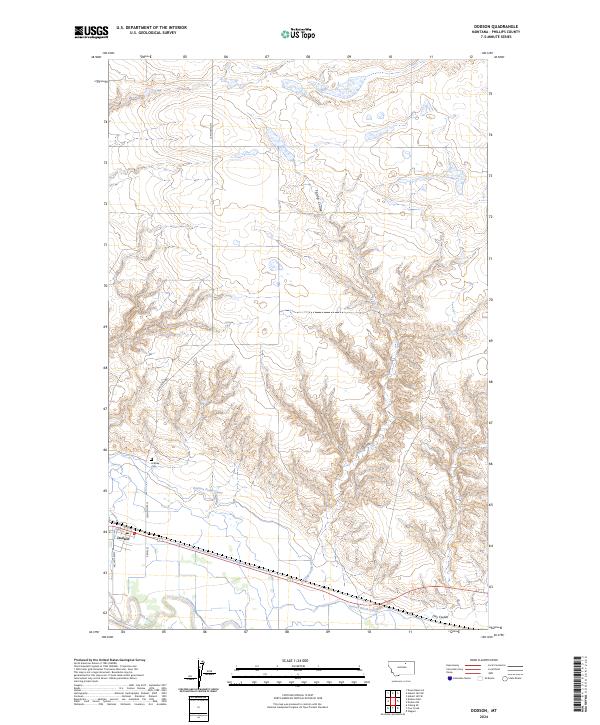
The town of Dodson serves as a vital hub in this Phillips County landscape, situated along the northern banks of the Milk River. This agricultural and water-management corridor is defined by the intricate path of the Dodson Pump Canal and the Dodson North Canal, which illustrate the complex irrigation infrastructure necessary for life in this part of Montana. North of the main settlement, the terrain is marked by seasonal drainages such as Spring Coulee and Hay Coulee, which cut through the higher ground. Genealogists and local historians will find the Hillside Cem north of town, a quiet landmark along N Dodson Rd. The map also captures the local transportation network, including the junction of State Hwy 204 and the town's street grid, including 1st St E and 2nd St E.
Find a feature on this map
18 named features on this map. Tap any name to fly to it.
Don’t see what you’re looking for? This feature index may not catch every label — zoom into the map to look around manually.
Map Details
Editions of this 2024 Dodson Map
This is the sole edition of this map. No revisions or reprints were ever made.
Historical Maps of Dodson Through Time
3 maps found