
1964 Map of Dodson
USGS Topo · Published 1967About this map
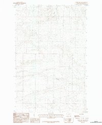
Dodson sits as the central hub of this northern Montana landscape, positioned where the Great Northern railroad tracks parallel the southern sweep of the Milk River. The settlement is closely tied to the surrounding Phillips County plains through a network of irrigation works, including the Dodson North Canal and Dodson South Canal, which trace the base of the dissected uplands. To the north, the terrain rises into the intricate drainage system of Spring Coulee, while the town itself serves as a local center for the region, hosting a Fairground and the Hillside Cem. The presence of several gravel pits and a designated Landing Area indicates the rural infrastructure supporting this agricultural and transport corridor during the mid-1960s.
Find a feature on this map
17 named features on this map. Tap any name to fly to it.
Don’t see what you’re looking for? This feature index may not catch every label — zoom into the map to look around manually.
Map Details
Editions of this 1964 Dodson Map
This is the sole edition of this map. No revisions or reprints were ever made.
Other maps of this area

1920 · Avery
USGS Topo · 1:125,000

1953 · Havre
USGS Topo · 1:250,000

1957 · Havre
USGS Topo · 1:250,000

1958 · Havre
USGS Topo · 1:250,000

1964 · Dodson NE
USGS Topo · 1:24,000

1964 · Coburg SE
USGS Topo · 1:24,000

1964 · Cow Creek
USGS Topo · 1:24,000

1964 · Dodson Dam
USGS Topo · 1:24,000

1965 · Wagner
USGS Topo · 1:24,000
1984 · Hubert Hill SW
USGS Topo · 1:24,000