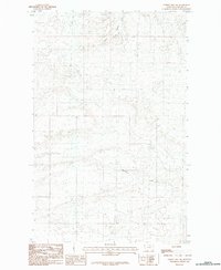
1984 Map of Hubert Hill SW
USGS Topo · Published 1984About this map
Drainage patterns and prairie topography define this portion of the northern plains in Phillips County, Montana. The landscape is primarily shaped by the seasonal flow of Assiniboine Creek, which winds across the southern reaches of the quadrangle. Further north, the terrain is incised by Joiner Coulee, a characteristic regional feature that reflects the arid climate and the way water has historically moved through this grazing land. This 1980s-era topographic survey provides a detailed view of the section lines and township boundaries that partitioned the West, illustrating the relationship between the natural watercourses and the legal grid of the American interior.
Find a feature on this map
2 named features on this map. Tap any name to fly to it.
Don’t see what you’re looking for? This feature index may not catch every label — zoom into the map to look around manually.
Map Details
Editions of this 1984 Hubert Hill SW Map
This is the sole edition of this map. No revisions or reprints were ever made.
Other maps of this area

1920 · Avery
USGS Topo · 1:125,000

1953 · Havre
USGS Topo · 1:250,000

1957 · Havre
USGS Topo · 1:250,000

1958 · Havre
USGS Topo · 1:250,000

1964 · Dodson NE
USGS Topo · 1:24,000

1964 · Dodson
USGS Topo · 1:24,000

1964 · Dodson Dam
USGS Topo · 1:24,000

1984 · Emerick Bench
USGS Topo · 1:24,000
1984 · Down Reservoir NE
USGS Topo · 1:24,000
1984 · Hubert Hill SE
USGS Topo · 1:24,000