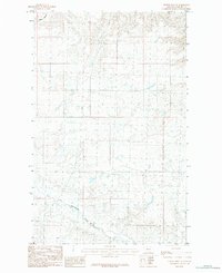
1984 Map of Hubert Hill SE
USGS Topo · Published 1984About this map
Assiniboine Creek winds through this expanse of northern Montana, where the terrain is marked by intermittent watercourses and technical survey markings. This mid-1980s provisional map serves as a primary record of the drainage patterns in this portion of Phillips County, detailing how moisture moves across the land through features like Wilson Coulee in the northwest corner. The land is characterized by numerous small depressions and basins, suggesting a landscape shaped by seasonal water movement and subtle elevation changes across the plains. Primarily a study of natural geography and hydrology, the map provides precise data for land management and environmental research in a region where water sources like these creeks are central to the landscape's identity.
Find a feature on this map
2 named features on this map. Tap any name to fly to it.
Don’t see what you’re looking for? This feature index may not catch every label — zoom into the map to look around manually.
Map Details
Editions of this 1984 Hubert Hill SE Map
This is the sole edition of this map. No revisions or reprints were ever made.
Other maps of this area

1920 · Avery
USGS Topo · 1:125,000

1920 · Cowan
USGS Topo · 1:125,000

1953 · Havre
USGS Topo · 1:250,000

1954 · Glasgow
USGS Topo · 1:250,000

1957 · Glasgow
USGS Topo · 1:250,000

1957 · Havre
USGS Topo · 1:250,000

1958 · Glasgow
USGS Topo · 1:250,000

1958 · Havre
USGS Topo · 1:250,000

1964 · Dodson NE
USGS Topo · 1:24,000

1964 · Dodson
USGS Topo · 1:24,000