
1920 Map of Cowan
USGS Topo · Published 1920About this map
The International Boundary forms the northern limit of this landscape, where the high plains of Phillips County meet the Canadian border. The area is defined by the winding course of the Milk River and the significant water storage at the Nelson Reservoir, featuring its documented Head Works. This survey, compiled under Col. Chas. L. Potter, captures a network of rural education and communication prior to the consolidation of modern districts. Numerous small schoolhouses, such as Hermanson School, Broderson School, and Austin School, are spaced across the township grid, often near drainages like Whitewater Creek and Little Cottonwood Creek. Local post offices at Freewater P.O. and Lovejoy P.O. serve as the primary hubs for scattered homesteads, while landmarks like Martin Lake and Rock Monument 29 provide essential navigation points in this open prairie terrain.
Find a feature on this map
24 named features on this map. Tap any name to fly to it.
Don’t see what you’re looking for? This feature index may not catch every label — zoom into the map to look around manually.
Map Details
Editions of this 1920 Cowan Map
This is the sole edition of this map. No revisions or reprints were ever made.
Other maps of this area
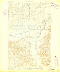
1905 · Bowdoin
USGS Topo · 1:62,500
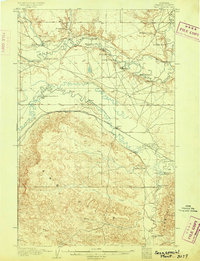
1905 · Saco Special
USGS Topo · 1:62,500

1920 · Avery
USGS Topo · 1:125,000

1953 · Havre
USGS Topo · 1:250,000

1954 · Glasgow
USGS Topo · 1:250,000

1957 · Glasgow
USGS Topo · 1:250,000

1957 · Havre
USGS Topo · 1:250,000

1958 · Glasgow
USGS Topo · 1:250,000

1958 · Havre
USGS Topo · 1:250,000
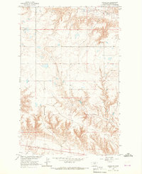
1964 · Dodson NE
USGS Topo · 1:24,000