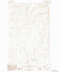
1984 Map of Down Reservoir NE
USGS Topo · Published 1984About this map
The high plains of Northern Montana are defined by the convergence of the Blaine Co and Phillips Co lines in this 1980s-era topographic study. The landscape is characterized by a network of drainage channels including Little Jewel Coulee and Black Coulee, which snake across the plateau. The terrain is largely dominated by the natural hydrology of the region, where seasonal water flow has carved distinct paths toward Reservoir Coulee in the east. This map captures the area as it was recorded during a 1979 field check, reflecting a sparse, rural environment where the primary features are defined by the relief of the coulees rather than human infrastructure or settlement. It provides a technical record of the land surface before contemporary digital mapping, emphasizing the subtle contours and boundaries of these two adjacent counties.
Find a feature on this map
4 named features on this map. Tap any name to fly to it.
Don’t see what you’re looking for? This feature index may not catch every label — zoom into the map to look around manually.
Map Details
Editions of this 1984 Down Reservoir NE Map
This is the sole edition of this map. No revisions or reprints were ever made.
Other maps of this area

1920 · Avery
USGS Topo · 1:125,000

1953 · Havre
USGS Topo · 1:250,000

1957 · Havre
USGS Topo · 1:250,000

1958 · Havre
USGS Topo · 1:250,000

1984 · Chapman
USGS Topo · 1:24,000

1984 · Emerick Bench
USGS Topo · 1:24,000

1984 · Turner
USGS Topo · 1:24,000
1984 · Hubert Hill SW
USGS Topo · 1:24,000
1984 · Down Reservoir NW
USGS Topo · 1:24,000
1984 · Down Reservoir SW
USGS Topo · 1:24,000