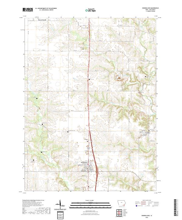
2022 Map of Donnellson
USGS Topo · Published 2022About this map
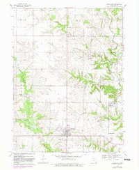
Donnellson serves as the central hub of this Lee County landscape, where a grid of rural roads connects established agricultural communities. The town is structured around key thoroughfares including State St and Main St, while the surrounding countryside is defined by the winding paths of Sugar Creek and Bonnell Cr. This 2022 survey documents a high density of burial grounds, many associated with early regional families and religious groups, such as the Busch Mennonite Cem and Evangelical Cem.
Find a feature on this map
53 named features on this map. Tap any name to fly to it.
Don’t see what you’re looking for? This feature index may not catch every label — zoom into the map to look around manually.
Map Details
Editions of this 2022 Donnellson Map
This is the sole edition of this map. No revisions or reprints were ever made.