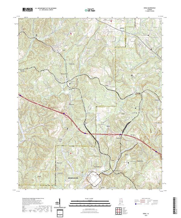
2024 Map of Dora
USGS Topo · Published 2024About this map
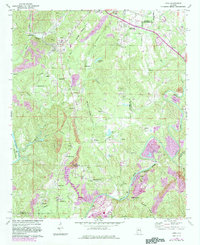
The Locust Fork and Mulberry Fork define the riverine geography of this region on the border of Walker and Jefferson counties. This 2024 survey documents a landscape where traditional river crossings like Littleton Ferry and Butlers Ferry remain named points of reference alongside modern industrial infrastructure such as the Miller Steam Plant Water Storage. The transportation corridor is anchored by the historic Old Bankhead route and the Bankhead Hwy, which connect established communities like Dora and Sumiton.
Find a feature on this map
65 named features on this map. Tap any name to fly to it.
Don’t see what you’re looking for? This feature index may not catch every label — zoom into the map to look around manually.
Map Details
Editions of this 2024 Dora Map
This is the sole edition of this map. No revisions or reprints were ever made.