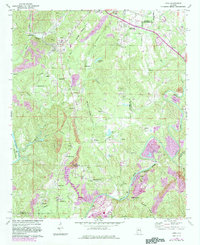
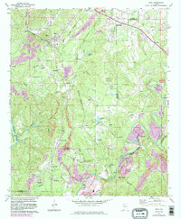
1971 Map of Dora
USGS Topo · Published 1983About this map
Industrial and community life along the border of Walker and Jefferson Counties centers on the confluence of several rail lines and waterways. The Burlington Northern, Southern, and Seaboard railroads crisscross the landscape, linking coal mining operations like the northern Strip Mine to settlement hubs such as Dora and Sumiton. Residential pockets and company towns are frequent, with family-named landmarks and local institutions like Dora High Sch and Morgan Chapel providing a sense of place amidst the heavy machinery of the era.
Find a feature on this map
64 named features on this map. Tap any name to fly to it.
Don’t see what you’re looking for? This feature index may not catch every label — zoom into the map to look around manually.
Map Details
Editions of this 1971 Dora Map
5 editions found
Other maps of this area

1889 · Birmingham
USGS Topo · 1:125,000

1892 · Birmingham
USGS Topo · 1:125,000

1893 · Jasper
USGS Topo · 1:125,000

1895 · Birmingham
USGS Topo · 1:125,000

1904 · Birmingham Coal District
USGS Topo · 1:62,500

1906 · Birmingham Special
USGS Topo · 1:62,500

1907 · Birmingham
USGS Topo · 1:125,000

1935 · Port Birmingham
USGS Topo · 1:48,000

1938 · Port Birmingham
USGS Topo · 1:62,500

1949 · Cordova
USGS Topo · 1:24,000