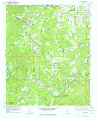
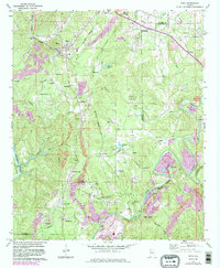
1971 Map of Dora
USGS Topo · Published 1977About this map
The Mulberry Fork and Locust Fork define the landscape of this region on the border of Walker and Jefferson counties. By the early 1970s, the area shows a complex intersection of industry and rural life, where major rail lines like the St Louis-San Francisco and Southern railroads serve numerous coal-adjacent settlements. Small communities and junctions, including West Jefferson, Dora, and Sumiton, are interspersed with local landmarks like Dora High Sch and a Drive-in Theater.
Find a feature on this map
59 named features on this map. Tap any name to fly to it.
Don’t see what you’re looking for? This feature index may not catch every label — zoom into the map to look around manually.
Map Details
Editions of this 1971 Dora Map
5 editions found
Other maps of this area

1889 · Birmingham
USGS Topo · 1:125,000

1892 · Birmingham
USGS Topo · 1:125,000

1893 · Jasper
USGS Topo · 1:125,000

1895 · Birmingham
USGS Topo · 1:125,000

1904 · Birmingham Coal District
USGS Topo · 1:62,500

1906 · Birmingham Special
USGS Topo · 1:62,500

1907 · Birmingham
USGS Topo · 1:125,000

1935 · Port Birmingham
USGS Topo · 1:48,000

1938 · Port Birmingham
USGS Topo · 1:62,500

1949 · Cordova
USGS Topo · 1:24,000