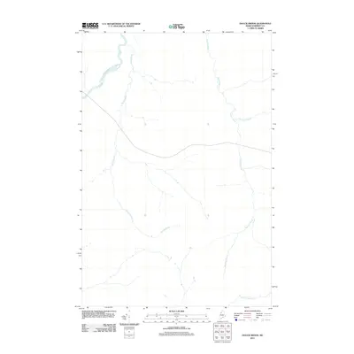
2011 Map of Doucie Brook
USGS Topo · Published 2011About this map
The Southwest Branch Saint John River defines the northwestern boundary of this Maine borderland, where the terrain is dominated by a complex network of waterways rather than human settlements. This 2011 survey illustrates a remote portion of Somerset County characterized by its drainage basins, including the long course of Doucie Brook and the southern reaches of Knowles Brook. A solitary logging road or woods trail traverses the center of the quadrangle, representing the only major infrastructure in a landscape otherwise defined by the seasonal flow of Comstock Brook and Desolation Brook. The lack of named towns or structures highlights the area's primary use for timber and natural resource management, offering a precise look at the hydrology of the North Maine Woods at the start of the decade.
Find a feature on this map
5 named features on this map. Tap any name to fly to it.
Don’t see what you’re looking for? This feature index may not catch every label — zoom into the map to look around manually.
Map Details
Editions of this 2011 Doucie Brook Map
This is the sole edition of this map. No revisions or reprints were ever made.
Other maps of this area

1954 · Baker Lake
USGS Topo · 1:62,500

1954 · Allagash Lake
USGS Topo · 1:62,500

1954 · Presque Isle
USGS Topo · 1:250,000

1955 · Beaver Pond
USGS Topo · 1:62,500

1955 · Clayton Lake
USGS Topo · 1:62,500

1958 · Presque Isle
USGS Topo · 1:250,000

1960 · Presque Isle
USGS Topo · 1:250,000

1961 · Allagash Lake
USGS Topo · 1:62,500

1962 · Baker Lake
USGS Topo · 1:62,500
1986 · Beaver Pond SE
USGS Topo · 1:24,000