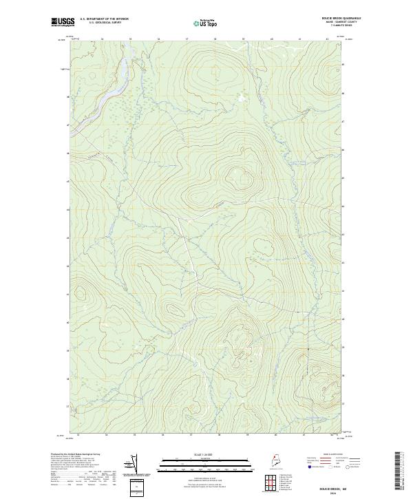
2024 Map of Doucie Brook
USGS Topo · Published 2024About this map
The Southwest Branch Saint John River winds through this secluded section of Somerset County, where the landscape is defined by an intricate network of waterways and timberlands. The terrain is deeply carved by several significant tributaries, including Doucie Brook, Knowles Brook, and Comstock Brook, which flow through the forested uplands toward the river. Transportation in this northern Maine region is limited to remote corridors such as St Juste Rd and Foss Brooke Rd, reflecting a landscape dedicated to wilderness and forestry rather than concentrated settlement. To the southeast, the drainage of Desolation Brook further illustrates the isolated character of this borderland environment, where topography and hydrology remain the dominant features of the land.
Find a feature on this map
7 named features on this map. Tap any name to fly to it.
Don’t see what you’re looking for? This feature index may not catch every label — zoom into the map to look around manually.
Map Details
Editions of this 2024 Doucie Brook Map
This is the sole edition of this map. No revisions or reprints were ever made.
Other maps of this area

1954 · Baker Lake
USGS Topo · 1:62,500

1954 · Allagash Lake
USGS Topo · 1:62,500

1954 · Presque Isle
USGS Topo · 1:250,000

1955 · Beaver Pond
USGS Topo · 1:62,500

1955 · Clayton Lake
USGS Topo · 1:62,500

1958 · Presque Isle
USGS Topo · 1:250,000

1960 · Presque Isle
USGS Topo · 1:250,000

1961 · Allagash Lake
USGS Topo · 1:62,500

1962 · Baker Lake
USGS Topo · 1:62,500
1986 · Beaver Pond SE
USGS Topo · 1:24,000