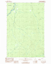
1989 Map of Doucie Brook
USGS Topo · Published 1989About this map
The Southwest Branch St John River flows through the northwest corner of this remote Somerset County landscape, a territory defined by industrial timberlands and organized township boundaries. This 1989 provisional survey documents the primitive road network and drainage patterns across areas like T 9 R 1 6 W E L S and T 1 0 R 1 6 W E L S, where the only named node of human activity is the Doucie Brook Campsite. The terrain is shaped by numerous seasonal waterways, including Knowles Brook and the descriptively named Desolation Brook, which drains from Desolation Pond in the southeast. These features, along with Comstock Bk, illustrate the complex hydrology of the Maine North Woods before later developments changed the backcountry access. The presence of routes marked as Private underscores the managed nature of this wilderness during the late twentieth century.
Find a feature on this map
14 named features on this map. Tap any name to fly to it.
Don’t see what you’re looking for? This feature index may not catch every label — zoom into the map to look around manually.
Map Details
Editions of this 1989 Doucie Brook Map
This is the sole edition of this map. No revisions or reprints were ever made.
Other maps of this area

1954 · Baker Lake
USGS Topo · 1:62,500

1954 · Allagash Lake
USGS Topo · 1:62,500

1954 · Presque Isle
USGS Topo · 1:250,000

1955 · Beaver Pond
USGS Topo · 1:62,500

1955 · Clayton Lake
USGS Topo · 1:62,500

1958 · Presque Isle
USGS Topo · 1:250,000

1960 · Presque Isle
USGS Topo · 1:250,000

1961 · Allagash Lake
USGS Topo · 1:62,500

1962 · Baker Lake
USGS Topo · 1:62,500
1986 · Beaver Pond SE
USGS Topo · 1:24,000