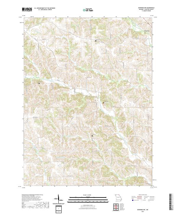
2021 Map of Downing NW
USGS Topo · Published 2021About this map
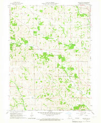
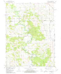
The N Fork Middle Fabius River and its numerous tributaries carve through the landscape of northwest Schuyler County, defining the drainage patterns around the settlement of Downing. This modern topographic survey highlights a predominantly agricultural and rural area where land use is closely tied to the shifting elevations of D & D Ridge and the river valleys. Local heritage is preserved in several small burial grounds scattered across the townships, including Webster Cem, Germania Cem, and Crowder Cem.
Find a feature on this map
46 named features on this map. Tap any name to fly to it.
Don’t see what you’re looking for? This feature index may not catch every label — zoom into the map to look around manually.
Map Details
Editions of this 2021 Downing NW Map
This is the sole edition of this map. No revisions or reprints were ever made.
Historical Maps of Downing Through Time
8 maps found