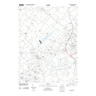
2010 Map of Doylestown
USGS Topo · Published 2010About this map
The North Branch Neshaminy Creek and its significant Peace Valley Reservoir dominate the central landscape of this Bucks County region. In the early 21st century, the area shows a distinct pattern of suburban density transitioning into agricultural parcels and wooded estates. Small residential developments like Lindenfield and Patriot Place surround the established borough of Chalfont, while the eastern edge of the map captures the outskirts of Doylestown, including the Doylestown Boro Post Office and the expansive Doylestown Cemetery.
Find a feature on this map
174 named features on this map. Tap any name to fly to it.
Don’t see what you’re looking for? This feature index may not catch every label — zoom into the map to look around manually.
Map Details
Editions of this 2010 Doylestown Map
This is the sole edition of this map. No revisions or reprints were ever made.
Other maps of this area

1888 · Quakertown
USGS Topo · 1:62,500

1890 · Doylestown
USGS Topo · 1:62,500

1890 · Quakertown
USGS Topo · 1:62,500

1891 · Doylestown
USGS Topo · 1:62,500

1893 · Germantown
USGS Topo · 1:62,500

1894 · Quakertown
USGS Topo · 1:62,500

1894 · Norristown
USGS Topo · 1:62,500

1894 · Germantown
USGS Topo · 1:62,500

1895 · Norristown
USGS Topo · 1:62,500

1896 · Germantown
USGS Topo · 1:62,500
Featured Places
- Warrington Township, PA
- Buckingham Township, PA
- Hilltown Township, PA
- Doylestown, PA
- Bedminster Township, PA