2021 Map of Drexel
USGS Topo · Published 2021About this map
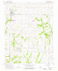
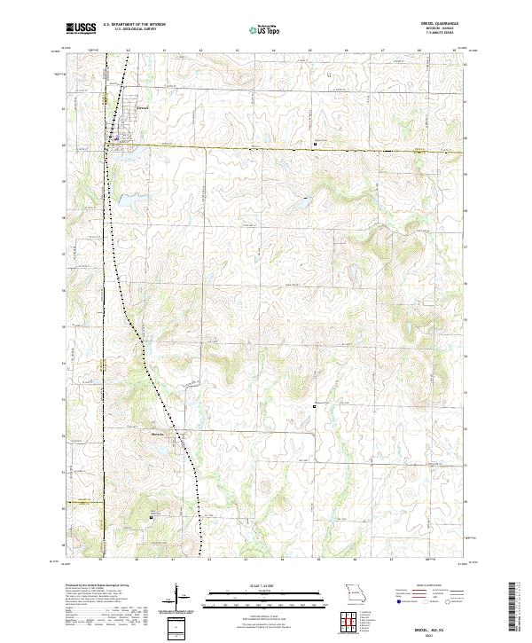
Drexel sits at the northern edge of this landscape, a settlement straddling the Kansas-Missouri border where Cass and Bates counties meet. The township layout is defined by a rigorous grid of section lines and rural roads, including State Hwy AA and E State Rte 18, which connect the agricultural hinterland to smaller hubs like Merwin. The terrain is shaped by the dendritic drainage patterns of Mormon Fork and Miami Cr, which carve subtle valleys across the plains. For local historians and genealogists, the map identifies several significant burial sites, including Sharon Cem to the east and Edgewood Cem near the center. The southern portion of the quadrangle reaches into Linn County, while the northern outskirts of Drexel are anchored by Drexel Lake and an industrial corridor, reflecting the town's evolution from a border rail stop to a modern rural center.
Find a feature on this map
66 named features on this map. Tap any name to fly to it.
Don’t see what you’re looking for? This feature index may not catch every label — zoom into the map to look around manually.
Map Details
Editions of this 2021 Drexel Map
This is the sole edition of this map. No revisions or reprints were ever made.