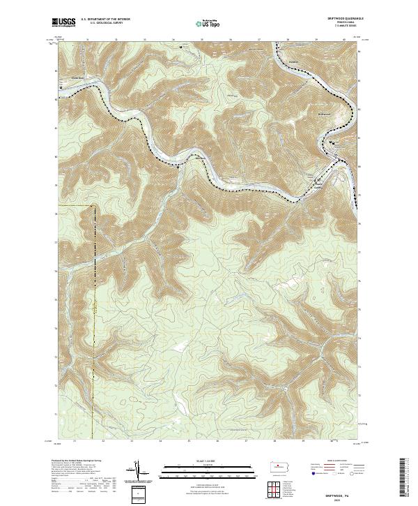
2023 Map of Driftwood
USGS Topo · Published 2023About this map
The confluence of Driftwood Branch Sinnemahoning Creek and Bennett Branch Sinnemahoning Creek forms the central geography of this Cameron County region. The borough of Driftwood serves as the primary hub, where historic street names like Driftwood Ave and Bridge St trace the town's orientation toward the water. To the south, Castle Garden and its associated Castle Garden Cem sit near the river's bend, while smaller settlements like Hicks Run and Mix Run follow the narrow valleys carved by their namesake streams.
Find a feature on this map
73 named features on this map. Tap any name to fly to it.
Don’t see what you’re looking for? This feature index may not catch every label — zoom into the map to look around manually.
Map Details
Editions of this 2023 Driftwood Map
This is the sole edition of this map. No revisions or reprints were ever made.
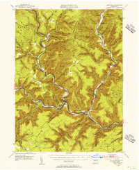
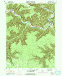
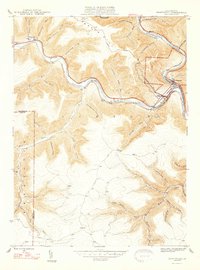
Historical Maps of Driftwood Through Time
4 maps found
Featured Locations
- Gibson Township, PA
- Driftwood, PA
- Benezette Township, PA
- Castle Garden, Gibson Township
- Hicks Run, Gibson Township