Old Maps of Cameron County, Pennsylvania
Explore 123 old maps of Cameron County, spanning from 1929 to today. These high-resolution historic maps reveal how streets, neighborhoods, landmarks, and natural features evolved over time — perfect for genealogy, metal detecting, research, and local history exploration.
What you can do with these maps:
- See how Cameron County changed over time: Compare historical maps to modern-day views to trace roads, homesites, rail lines & more.
- View detailed metadata: Each map includes creators, publishers, year, scale, and archive source.
- Overlay maps with satellite & LiDAR: Visualize the past alongside modern tools to explore terrain & human change.
- Trusted historical sources: Maps sourced from the USGS, Library of Congress, and other archives.
- Access maps your way: View online, download high-res files, or order prints for personal or research use.
Start exploring old maps of Cameron County to uncover forgotten places, hidden landmarks, and the deep history beneath your feet.
Cameron County, PA maps
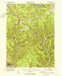
(123)- 1929 Map of Karthaus
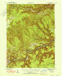
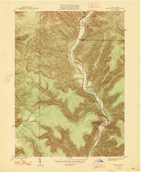
 1929 Karthaus1929 Print · USGSThe West Branch Susquehanna River and its steep hollows defined life in Clearfield County during the late twenties. Researchers can trace the riverfront New York Central Railroad and find dozens of rural school sites like Fairview Sch and the community at Frenchville.3 unique versions available
 - 1932 Map of Karthaus
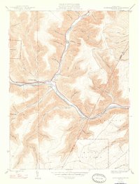
 1932 Karthaus1932 Print · USGSThe Susquehanna’s West Branch winds through Clearfield and Centre Counties in the late 1920s, a landscape shaped by the rail and timber industries. Genealogists can trace family names through dozens of rural schools and churches like Mignot Sch and Fairview Ch.3 unique versions available
 - 1941 Map of Benezette, 1952 Print
 1941 Benezette1952 Print · USGSElk County at the start of the 1940s reveals a network of valley settlements defined by the Pennsylvania RR and Sinnemahoning Creek. Researchers can trace rural life through scattered landmarks like Mt Zion Ch, Rathbun Sch, and the high point at Winslow Hill.3 unique versions available
 - 1943 Map of Benezette
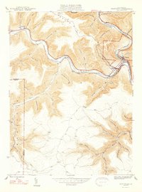
 1943 Benezette1943 Print · USGSElk and Cameron counties are captured during the early 1940s, showing a landscape of deep timber-run hollows and active rail corridors. Local historians can locate vanished schoolhouses like Rathbun Sch, mountain churches such as Mt Zion Ch, and the winding tracks of the Pennsylvania railroad.2 unique versions available
 - 1945 Map of Driftwood, 1953 Print
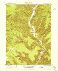
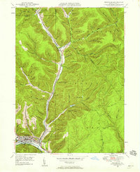
 1945 Driftwood1953 Print · USGSCameron County communities thrive along the river bends and rail lines at the end of World War II. Researchers can trace the dual rail paths of the Pennsylvania and Baltimore and Ohio railroads through Driftwood and locate the First Fork Sch.4 unique versions available
 - 1945 Map of First Fork, 1954 Print
 1945 First Fork1954 Print · USGSThe deep valleys of Cameron and Potter counties appear here in the mid-1940s, centered on the First Fork Sinnemahoning Creek corridor. Local researchers can locate the First Fork School, Gilmore Cem, and early ridge-top routes like Square Timber Road.3 unique versions available
 - 1945 Map of Sinnemahoning, 1954 Print
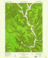
 1945 Sinnemahoning1954 Print · USGSSinnemahoning and the surrounding river valleys are captured here at the height of the steam-to-diesel rail transition. Historians can trace the competing paths of the Pennsylvania and Baltimore and Ohio railroads through Jericho and past Miller Cem.5 unique versions available
 - 1945 Map of Driftwood, 1955 Print
 1945 Driftwood1955 Print · USGSCameron and Elk Counties reveal their mid-century industrial character along the river valleys of the Allegheny Plateau. Researchers can trace the dual influence of the Baltimore and Ohio railroad and isolated mountain burial grounds like Mason Hill Cem and Mix Run Cem.3 unique versions available
 - 1945 Map of Cameron, 1958 Print
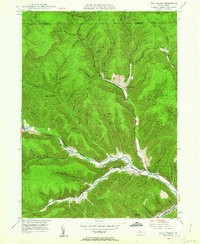
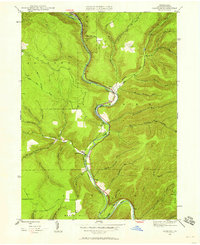 1945 Cameron1958 Print · USGSCameron County in the 1940s is defined by the winding course of the Driftwood Branch Sinnemahoning Creek and its vital rail corridor. Researchers can trace family sites at Pine St Cem or explore the rugged topography of Mason Hill and Hunts Run.3 unique versions available
 - 1946 Map of Renovo West, 1953 Print
 1946 Renovo West1953 Print · USGSClinton County's river valleys and ridgelines come alive in this mid-century survey of the Pennsylvania wilds. Trace the industrial footprint of the Pennsylvania RR through Renovo or find family history at Laurel Hill Cem and Summerson Cem.9 unique versions available
 - 1946 Map of Hammersley Fork, 1954 Print
 1946 Hammersley Fork1954 Print · USGSThe deep valleys of north-central Pennsylvania appear just after the war as small creek-side settlements remain the primary nodes of local life. Genealogists can trace family names at Summerson Cem and McCoy Cem or locate the old Central Sch near Hammersley Fork.4 unique versions available
 - 1946 Map of Keating, 1954 Print
 1946 Keating1954 Print · USGSClinton County’s deep river valleys and high ridges are shown just after the war, centered on the strategic rail junction at Keating. Genealogists and industrial historians can trace the New York Central line through the mountains and locate the settlement at Bitumen.4 unique versions available
 - 1947 Map of Cameron
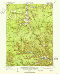
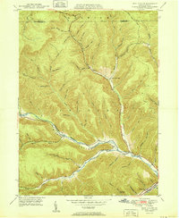
 1947 Cameron1947 Print · USGSCameron and Sterling Run are captured in the late 1940s as they follow the deep curves of the Driftwood Branch Sinnemahoning Creek. Local historians can trace family plots at Pine St Cem or locate the site of the early Slyder Airport near Hunts Run.2 unique versions available
 - 1947 Map of First Fork
 1947 First Fork1947 Print · USGSNorth-central Pennsylvania's mountain valleys are captured here in the mid-1940s, as small settlements and logging-era roads traced the winding First Fork Sinnemahoning Creek. Genealogists can locate the First Fork Sch and family burial sites like Smith Cem and Gilmore Cem.2 unique versions available
 - 1947 Map of Sinnemahoning
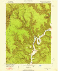
 1947 Sinnemahoning1947 Print · USGSCameron and Clinton counties are depicted in the mid-1940s at a time when the railroad and river defined local life. Genealogists and historians can trace family locations near Sinnemahoning, Driftwood, and Miller Cem, or follow the Baltimore and Ohio line.2 unique versions available
 - 1947 Map of Driftwood
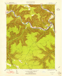
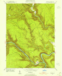
 1947 Driftwood1947 Print · USGSCameron County's rugged rail corridors and remote river valleys are captured here just after the war. Researchers can trace historic family burial sites at Mason Hill Cem and Mix Run Cem or locate the old junctions at Driftwood and Castle Garden.2 unique versions available
 - 1948 Map of Keating
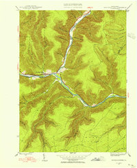
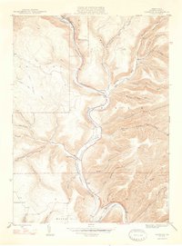
 1948 Keating1948 Print · USGSThe confluence of the Susquehanna and Sinnemahoning Creek appears in the late 1940s as a vital railroad corridor through the mountains. Genealogists and historians can trace the riverside rail stops at Keating and Wistar or the upland community of Bitumen.
 - 1948 Map of Hammersley Fork
 1948 Hammersley Fork1948 Print · USGSClinton and Potter counties appear here in the late 1940s, highlighting the rural communities nestled along the winding waters of Kettle Creek. Genealogists can locate family landmarks such as Summerson Cem, McCoy Cem, and the Central Sch.2 unique versions available
 - 1948 Map of Crosby, 1952 Print
 1948 Crosby1952 Print · USGSPost-war McKean and Cameron counties appear here as a landscape of mountain rail lines and valley settlements. Trace the Pennsylvania Railroad through Hamlin Sta, locate the Sweets Sch, or find family names near Clermont Cem.3 unique versions available
 - 1948 Map of Emporium, 1952 Print
 1948 Emporium1952 Print · USGSThe northern Pennsylvania highlands come into focus in the late 1940s, showing a network of mountain settlements and headwater streams. You can trace family roots at Wharton Cem and St Marks Cem or locate old schoolhouse sites like Reesville Sch.3 unique versions available
 - 1948 Map of Emporium, 1958 Print
 1948 Emporium1958 Print · USGSEmporium and the Sinnemahoning valley are captured here just after the war, showing the railroad and highway networks through the Cameron County mountains. Genealogists can trace family names across Newton Cem, Sizerville, and Prospect Park.6 unique versions available
 - 1948 Map of Wildwood Fire Tower, 1958 Print
 1948 Wildwood Fire Tower1958 Print · USGSThe Pennsylvania high country of Elk and McKean counties comes into focus in the years just after the war, showing a landscape of deep hollows and forest runs. Genealogists and hikers can trace the remote reaches of Wellendorf Station, Devils Hole, and Boy Scout Hollow.5 unique versions available
 - 1948 Map of Wharton, 1958 Print
 1948 Wharton1958 Print · USGSMid-century Potter County comes to life along the winding First Fork Sinnemahoning Creek and its narrow tributary hollows. Genealogists can pinpoint old family burial grounds like Forest Hill Cem and local landmarks like the Reesville Sch.3 unique versions available
 - 1948 Map of Rich Valley, 1962 Print
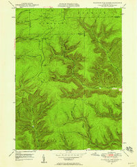
 1948 Rich Valley1962 Print · USGSCameron County in the late 1940s is defined by its deep valleys and the winding path of the Sinnemahoning. Genealogists and historians can trace old homesteads and landmarks like Lockwood, the Swesey Sch, and the North Creek Chapel along the rail and river corridors.4 unique versions available
 - 1950 Map of Rich Valley
 1950 Rich Valley1950 Print · USGSCameron and McKean counties in the early postwar era are defined by the steep hollows of the Pennsylvania Wilds. Genealogists can trace family names and small-town footprints at Lockwood, Weber City, and the North Creek Chapel.2 unique versions available
Showing maps 1-25 of 123
Top cities of Cameron County
Frequently asked questions
- What are the different types of historical maps available for Cameron County?
- What is the oldest map of Cameron County?
- Where can I purchase historical maps of Cameron County for my home or office?
- Where can I download high-res historical maps of Cameron County?
- Are there historical topographic maps available for Cameron County?
- Is there historical aerial imagery available for Cameron County?
- Where are historical maps of Cameron County sourced from?