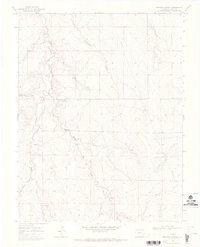
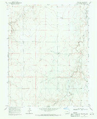
1968 Map of Dripping Spring
USGS Topo · Published 1971About this map
Selders Ranch stands as a primary point of human settlement in this high plains landscape of Bent County during the late 1960s. The map reveals an intricate drainage system defined by the rugged carving of Rattlesnake Creek and the meandering path of Mud Creek, which flows southeast toward its confluence with the aptly named Little Angry Creek. The terrain is marked by numerous springs, most notably the eponymous Dripping Spring, which likely served as vital water sources in this semi-arid environment.
Find a feature on this map
9 named features on this map. Tap any name to fly to it.
Don’t see what you’re looking for? This feature index may not catch every label — zoom into the map to look around manually.
Map Details
Editions of this 1968 Dripping Spring Map
This is the sole edition of this map. No revisions or reprints were ever made.
Other maps of this area

1892 · Two Butte
USGS Topo · 1:125,000

1893 · Two Butte
USGS Topo · 1:125,000

1955 · La Junta
USGS Topo · 1:250,000

1958 · La Junta
USGS Topo · 1:250,000

1967 · Hand Springs
USGS Topo · 1:24,000

1968 · La Junta
USGS Topo · 1:250,000
1968 · Cat Creek
USGS Topo · 1:24,000
1968 · Denny Lake
USGS Topo · 1:24,000
1968 · Cat Creek NW
USGS Topo · 1:24,000
1968 · High Rock
USGS Topo · 1:24,000