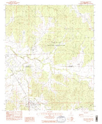
1983 Map of Duck Hill
USGS Topo · Published 1983About this map
Duck Hill sits at the base of this landscape, where the Illinois Central Gulf railroad follows the winding valley of Big Bogue. This 1983 provisional survey captures a predominantly rural area on the border of Grenada and Montgomery counties, dominated by the expansive Camp McCain Military Reservation which occupies the northern hills. The terrain is defined by a dense network of waterways, including Batupan Bogue and Little Bogue Creek, which shaped the early settlement patterns of small communities like Elliott and Sykes. For genealogists and local historians, the map provides precise locations for rural institutions such as the High Sch in Duck Hill and religious landmarks like Bethlehem Cem, Mt Pisgah Ch, and Mt Pleasant Ch, offering a clear view of the social geography before late-twentieth-century developments altered the character of these crossroads.
Find a feature on this map
28 named features on this map. Tap any name to fly to it.
Don’t see what you’re looking for? This feature index may not catch every label — zoom into the map to look around manually.
Map Details
Editions of this 1983 Duck Hill Map
2 editions found
Other maps of this area

1953 · West Point
USGS Topo · 1:250,000

1954 · Grenada
USGS Topo · 1:62,500

1954 · Duck Hill
USGS Topo · 1:62,500

1954 · McCarley
USGS Topo · 1:62,500

1955 · Coffeeville
USGS Topo · 1:62,500

1958 · West Point
USGS Topo · 1:250,000

1963 · West Point
USGS Topo · 1:250,000
1983 · Tie Plant
USGS Topo · 1:24,000
1983 · Eskridge
USGS Topo · 1:24,000
1983 · Duck Hill
USGS Topo · 1:24,000