2021 Map of Dupree
USGS Topo · Published 2021About this map
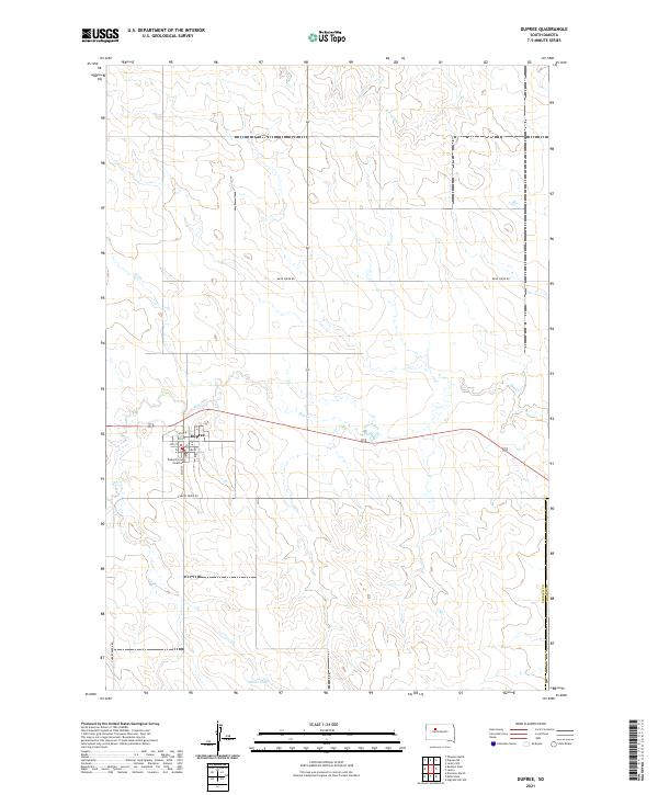
Dupree serves as the focal point of this Ziebach County landscape, situated at the intersection of a local street grid and regional transit routes. The town’s civic importance is anchored by the Ziebach County Courthouse, which remains a central landmark for researchers of local administration and genealogy. The surrounding terrain is defined by the winding course of Elm Creek and its various tributaries, including Pretty Creek and Ash Creek, illustrating a landscape shaped by intermittent water sources and ranching infrastructure.
Find a feature on this map
20 named features on this map. Tap any name to fly to it.
Don’t see what you’re looking for? This feature index may not catch every label — zoom into the map to look around manually.
Map Details
Editions of this 2021 Dupree Map
This is the sole edition of this map. No revisions or reprints were ever made.