Loading...
Loading map...2023 Map of Duran
USGS Topo · Published 2023About this map
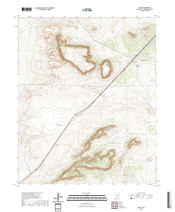
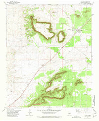
Duran serves as the focal point of this high-desert landscape in Torrance County, situated at a junction of rail lines and local roads including Co RD b086. The terrain is defined by a series of prominent mesas and volcanic features, most notably the sprawling Trinchera Mesa and the nearby Valencia Hills. These elevations are punctuated by strategic crossings such as Serape Pass and Roach Pass, which provide passage through the rugged topography that surrounds the settlement.
Find a feature on this map
19 named features on this map. Tap any name to fly to it.
Don’t see what you’re looking for? This feature index may not catch every label — zoom into the map to look around manually.
Map Details
Date Portrayed2023
Date Published2023
PublisherU.S. Geological Survey
Map TypeTopographic
Scale1:24000
Physical Dimensions24 x 29 inches
Editions of this 2023 Duran Map
This is the sole edition of this map. No revisions or reprints were ever made.
Historical Maps of Duran Through Time
Featured Locations
Source Details
SourceU.S. Geological Survey
CopyrightPublic Domain