Loading...
Loading map...2024 Map of Durand
USGS Topo · Published 2024About this map
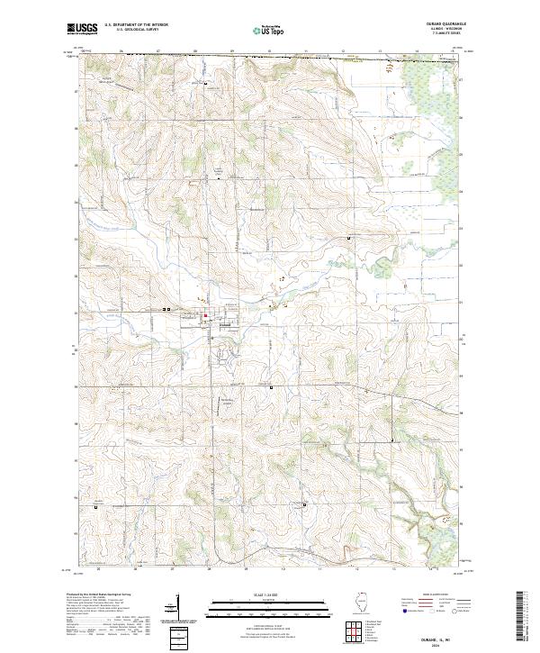
The village of Durand serves as the central hub of this northern Illinois landscape, positioned just south of the Wisconsin Illinois state line. This modern survey illustrates a region defined by its intersection of water and agriculture, where the Pecatonica River and Sugar River converge in the southeastern corner. The local road network, including Freeport Rd and Durand Rd, connects a series of long-standing community landmarks.
Find a feature on this map
44 named features on this map. Tap any name to fly to it.
Don’t see what you’re looking for? This feature index may not catch every label — zoom into the map to look around manually.
Map Details
Date Portrayed2024
Date Published2024
PublisherU.S. Geological Survey
Map TypeTopographic
Scale1:24000
Physical Dimensions24 x 29 inches
Editions of this 2024 Durand Map
This is the sole edition of this map. No revisions or reprints were ever made.
Historical Maps of Pecatonica Township Through Time
Featured Locations
Source Details
SourceU.S. Geological Survey
CopyrightPublic Domain