
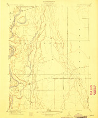
1912 Map of Durham
USGS Topo · Published 1912About this map
The Diamond Match Factory and its nearby worker settlements of Barber and Chapmantown define the industrial landscape of the northern Sacramento Valley just before World War I. This 1910 survey documents the rapid growth of Chico and its surrounding additions, including Chico Vecino and the State University Farm. To the south, the village of Durham serves as a hub for the agricultural lands of Esquon and Aguas Frias, connected by the competing corridors of the Southern Pacific RR and the Northern Electric RR. The map preserves the transition from the large Spanish land grants like Rancho De Farwell to a more subdivided grid of family farms and schools such as York School. Notable educational landmarks including the State Normal School are centrally located within the developing urban core of Chico near the banks of Chico Creek.
Find a feature on this map
29 named features on this map. Tap any name to fly to it.
Don’t see what you’re looking for? This feature index may not catch every label — zoom into the map to look around manually.
Map Details
Editions of this 1912 Durham Map
This is the sole edition of this map. No revisions or reprints were ever made.
Other maps of this area

1891 · Chico
USGS Topo · 1:125,000

1893 · Chico
USGS Topo · 1:125,000

1895 · Chico
USGS Topo · 1:125,000

1912 · Dry Creek
USGS Topo · 1:31,680

1912 · Nord
USGS Topo · 1:31,680

1912 · Chico Landing
USGS Topo · 1:31,680

1912 · Nelson
USGS Topo · 1:31,680

1912 · Keefers
USGS Topo · 1:31,680

1912 · Clear Creek
USGS Topo · 1:31,680
1912 · Newhard
USGS Topo · 1:31,680