Old Maps of Chico, California
Explore 41 old maps of Chico, spanning from 1891 to today. These high-resolution historic maps reveal how streets, neighborhoods, landmarks, and natural features evolved over time — perfect for genealogy, metal detecting, research, and local history exploration.
What you can do with these maps:
- See how Chico changed over time: Compare historical maps to modern-day views to trace roads, homesites, rail lines & more.
- View detailed metadata: Each map includes creators, publishers, year, scale, and archive source.
- Overlay maps with satellite & LiDAR: Visualize the past alongside modern tools to explore terrain & human change.
- Trusted historical sources: Maps sourced from the USGS, Library of Congress, and other archives.
- Access maps your way: View online, download high-res files, or order prints for personal or research use.
Start exploring old maps of Chico to uncover forgotten places, hidden landmarks, and the deep history beneath your feet.
Chico, CA maps
(41)- 1891 Map of Chico
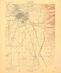
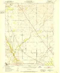
 1891 Chico1891 Print · USGSUpper Sacramento Valley life in the late nineteenth century revolved around the rail lines and river landings of Chico and Oroville. Genealogists and researchers can trace the early layout of mountain settlements like Magalia and Nimshew or locate old industrial sites including Keefers Old Mill and Doons Mill.
 - 1893 Map of Chico
 1893 Chico1893 Print · USGSNorthern California at the height of the nineteenth-century rail and ranching era reveals a network of valley landings and mountain mining camps. Genealogists and historians can trace family locations from Chico to remote spots like Helltown, Old Lovelock, and the Lucretia Mine.
 - 1895 Map of Chico
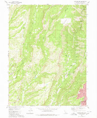
 1895 Chico1895 Print · USGSNorthern California at the close of the nineteenth century reveals a landscape defined by the Southern Pacific R. R. and early foothill industry. Trace the locations of historic lumber and mining operations like Keefer's Mill, Lucky Jim Mine, and Chapman's Mill.8 unique versions available
 - 1912 Map of Durham
 1912 Durham1912 Print · USGSNorthern Sacramento Valley industry and agriculture thrive in the decade before the Great War. Genealogists can trace the early streets of Chico, the worker housing at Barber, and rural schools like York School near the Diamond Match Factory.
 - 1912 Map of Nord
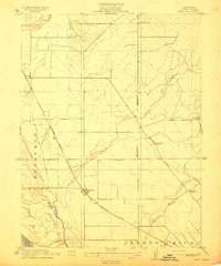 1912 Nord1912 Print · USGSThe northern Sacramento Valley thrived as a rail-dependent agricultural corridor in the early twentieth century. Genealogists can trace early homesteads near the Southern Pacific RR and locate rural landmarks like Antelope School and Cana.2 unique versions available
 - 1912 Map of Chico Landing
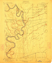 1912 Chico Landing1912 Print · USGSThe Sacramento River corridor near Butte County was a landscape of winding sloughs and emerging rail lines in the early twentieth century. Researchers can trace the footprints of riverside settlements like Munroeville, find old schools such as River Road School, and locate historical crossings of the Northern Electric RR.2 unique versions available
 - 1912 Map of Keefers
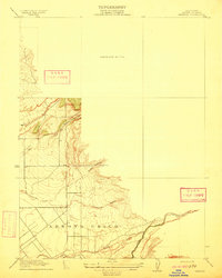 1912 Keefers1912 Print · USGSButte County land and water rights are visible in high detail on this 1912 preliminary survey of the northern Central Valley. Genealogists and land researchers can trace the early drainage and ranching terrain along Arroyo Chico, Mud Creek, and Sycamore Creek.2 unique versions available
 - 1944 Map of Richardson Springs
 1944 Richardson Springs1944 Print · USGSNorthern California's Butte and Tehama counties were transitioning during the early war years, balancing ranching with new military aviation. Trace the historic Southern Pacific rail line through Cana or locate family landmarks like the Pine Creek Cem and Richardson Springs.2 unique versions available
 - 1948 Map of Chico, 1955 Print
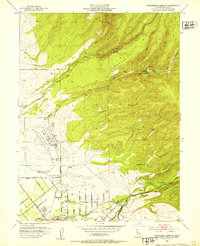
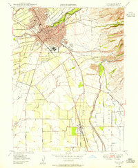 1948 Chico1955 Print · USGSNorthern California at the dawn of the fifties shows a bustling college town integrated with heavy industry and agriculture. Genealogists can trace family footprints from the Diamond Match Factory to the Durham Cem or the classrooms of the State College.5 unique versions available
 - 1949 Map of Chico, 1953 Print
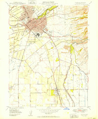
 1949 Chico1953 Print · USGSMid-century Butte County thrives along the river and rail, from the academic center of Chico to the agricultural hubs of Durham and Nelson. Genealogists and researchers can trace local landmarks like Chico Cem, the Match Factory, and the Sacramento Northern railroad.3 unique versions available
 - 1949 Map of Ord Ferry, 1957 Print
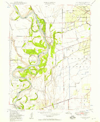 1949 Ord Ferry1957 Print · USGSThe Sacramento River valley at mid-century reveals a landscape of historic land grants and shifting river channels. Genealogists and researchers can trace local landmarks like Bidwell Sch, the Chico Landing site, and the river crossing at Ord Ferry.3 unique versions available
 - 1950 Map of Chico
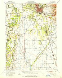
 1950 Chico1950 Print · USGSChico and its surrounding ranchos are captured in detail during the post-war era, showing the city's expansion alongside the Southern Pacific tracks. Genealogists and researchers can trace local landmarks like the Diamond Match Factory, Durham Cem, and the State College campus.2 unique versions available
 - 1950 Map of Ord Ferry
 1950 Ord Ferry1950 Print · USGSThe Sacramento River bottomlands near the Butte and Glenn county line come into focus just after the war. Local historians can trace early valley river life through sites like Ord Ferry, the Bidwell Sch, and the historical site of Chico Landing.
 - 1951 Map of Nord, 1952 Print
 1951 Nord1952 Print · USGSNorthern Butte County thrived as an orchard and rail corridor during the mid-century, before modernization shifted the rural landscape. Researchers can locate the Shasta Union Sch, trace the Southern Pacific tracks, or find family plots at the Pine Creek Cem.4 unique versions available
 - 1951 Map of Richardson Springs, 1953 Print
 1951 Richardson Springs1953 Print · USGSThe Butte County foothills and the northern edge of Chico are captured here in the early fifties as the region transitioned from rural arroyos to suburban expansion. Genealogists and local historians can trace family-named avenues and landmarks like Richardson Springs, Pleasant Valley School, and the Chico Municipal Airport.5 unique versions available
 - 1952 Map of Richardson Springs, 1959 Print
 1952 Richardson Springs1959 Print · USGSNorth of Chico in the early 1950s, the landscape shifts from the flat valley floor near Nord to the steep canyons of the Lassen National Forest. You can trace family ranching history at Stephens Ranch, locate the Old Spanish Corral, or find the secluded Richardson Springs resort area.2 unique versions available
 - 1953 Map of Paradise, 1955 Print
 1953 Paradise1955 Print · USGSButte County ridge life and the Sierra Nevada foothills are documented here in the early fifties, before the region's massive modern growth. Genealogists and historians can trace the foundations of Paradise and locate historic spots like Nimshew, the Magalia Mine, and the Southern Pacific line to Stirling City.5 unique versions available
 - 1958 Map of Chico, 1962 Print
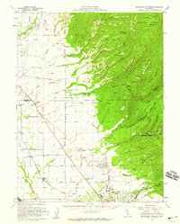
 1958 Chico1962 Print · USGSMid-century Northern California comes to life across the Central Valley and high Sierras as the postwar economy transformed the landscape. Trace the rail lines of the Southern Pacific RR, locate family roots near Chico Cem, or explore the early layout of Paradise and Beale Air Force Base.4 unique versions available
 - 1960 Map of Chico
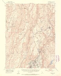
 1960 Chico1960 Print · USGSThe Northern California high country and Sacramento Valley meet in this 1960s-era landscape of mining towns and river settlements. Trace the rail-and-water economy of the gold country through the Empire Mine, Beale Air Force Base, and the Western Pacific Railroad.
 - 1980 Map of Chico
 1980 Chico1980 Print · USGSButte County and the Sierra foothills are shown here in the 1980s as the region's water and timber economies matured. Genealogists and researchers can trace old land grants like Rancho Capay or locate mountain mining sites and settlements such as Cherokee, Magalia, and the Big Bend Mine.2 unique versions available
 - 1980 Map of Paradise West
 1980 Paradise West1980 Print · USGSButte County's high ridges and deep canyons come into focus in the early eighties as residential growth reaches the Paradise area. Trace old foothill settlements and mining era relics like Helltown, Irish Town, and the Indian Spring Mine.4 unique versions available
 - 2012 Map of Nord, 2012 Print
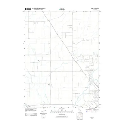 2012 Nord2012 Print · USGSCovers Chico, including Nord, Cana, and other nearby areas
 - 2012 Map of Ord Ferry, 2012 Print
 2012 Ord Ferry2012 Print · USGSCovers Chico, including Durham, Hamilton City, and other nearby areas
 - 2012 Map of Richardson Springs, 2012 Print
 2012 Richardson Springs2012 Print · USGSCovers Chico, including Richardson Springs, Butte County, and other nearby areas
 - 2012 Map of Chico, 2012 Print
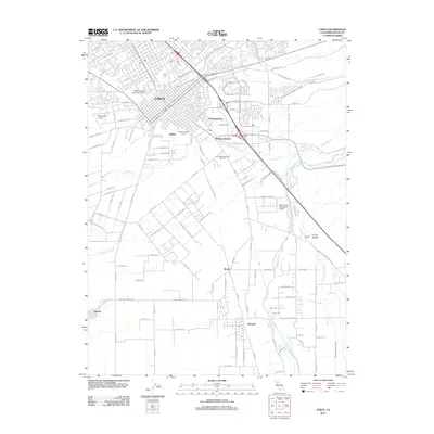 2012 Chico2012 Print · USGSCovers Chico, including Durham, Dayton, and other nearby areas
Showing maps 1-25 of 41
Top cities near Chico
Top neighborhoods of Chico
- Stirling Junction historical maps
- Barber historical maps
- Chapmantown historical maps
- City Plaza historical maps
- No sidewalk riding district historical maps
Frequently asked questions
- What are the different types of historical maps available for Chico?
- What is the oldest map of Chico?
- Where can I purchase historical maps of Chico for my home or office?
- Where can I download high-res historical maps of Chico?
- Are there historical topographic maps available for Chico?
- Is there historical aerial imagery available for Chico?
- Where are historical maps of Chico sourced from?