
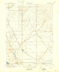
1912 Map of Nord
USGS Topo · Published 1912About this map
Nord and Cana appear as vital rural hubs along the Southern Pacific RR during a period of agricultural expansion in the Sacramento Valley. This 1910 survey, published by George Otis Smith, captures the landscape before modern irrigation transformed the region. The map reveals a community structured around its educational and transport networks, with the Shasta Road and the Marysville Line cutting through large tracts of land like Bosquejo and Arroyo Chico. Local life is anchored by several country schools, including Antelope School, Rock Creek School, and Webster School, which served the scattered farmsteads near Rock Creek and Mud Creek. The presence of the Gianelli Bridge over the river bottomlands highlights the essential infrastructure required to navigate the seasonal waterways of Sharkey Bottom and Sycamore Cr at the start of the twentieth century.
Find a feature on this map
18 named features on this map. Tap any name to fly to it.
Don’t see what you’re looking for? This feature index may not catch every label — zoom into the map to look around manually.
Map Details
Editions of this 1912 Nord Map
2 editions found
Other maps of this area

1891 · Chico
USGS Topo · 1:125,000

1893 · Chico
USGS Topo · 1:125,000

1895 · Chico
USGS Topo · 1:125,000

1904 · Vina
USGS Topo · 1:62,500

1906 · Willows
USGS Topo · 1:62,500

1912 · Durham
USGS Topo · 1:31,680

1912 · Chico Landing
USGS Topo · 1:31,680

1912 · Keefers
USGS Topo · 1:31,680

1912 · Singer Creek
USGS Topo · 1:31,680

1914 · Hamilton
USGS Topo · 1:31,680