
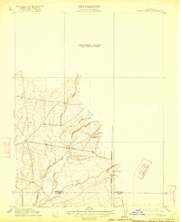
1912 Map of Singer Creek
USGS Topo · Published 1912About this map
Singer Creek and its neighboring seasonal drainages carve through this rural landscape along the northern edge of the Sacramento Valley during the early twentieth century. Surveyed under the direction of Chief Geographer R.B. Marshall, the topography reveals a network of intermittent streams including Brush Creek, Rattlesnake Creek, and Camel Creek. The transition from the valley floor to the rising eastern foothills is marked by the Tehama Co Butte Co boundary line, which cuts through the southern portion of the survey.
Find a feature on this map
10 named features on this map. Tap any name to fly to it.
Don’t see what you’re looking for? This feature index may not catch every label — zoom into the map to look around manually.
Map Details
Editions of this 1912 Singer Creek Map
2 editions found
Other maps of this area

1886 · Lassen Peak
USGS Topo · 1:250,000

1890 · Red Bluff
USGS Topo · 1:250,000

1891 · Chico
USGS Topo · 1:125,000

1892 · Lassen Peak
USGS Topo · 1:250,000

1893 · Chico
USGS Topo · 1:125,000

1894 · Lassen Peak
USGS Topo · 1:250,000

1894 · Red Bluff
USGS Topo · 1:250,000

1895 · Chico
USGS Topo · 1:125,000

1904 · Vina
USGS Topo · 1:62,500

1905 · Tehama
USGS Topo · 1:62,500