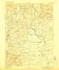
1890 Map of Red Bluff
USGS Topo · Published 1890About this map
The Oregon Division Central Pacific Railroad follows the Sacramento River southward through a landscape defined by pioneer-era river crossings and remote mountain outposts. This 1890s survey documents a time when the Trinity River and Clear Creek supported thriving mining and agricultural communities like Minersville, French Gulch, and Weaverville. The river network is dotted with essential infrastructure, including Logan's Ferry, Ball's Ferry, and Jelley's Ferry, providing vital links between the developing rail corridor and the western mountain ranges.
Find a feature on this map
179 named features on this map. Tap any name to fly to it.
Don’t see what you’re looking for? This feature index may not catch every label — zoom into the map to look around manually.
Map Details
Editions of this 1890 Red Bluff Map
This is the sole edition of this map. No revisions or reprints were ever made.
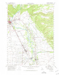
Historical Maps of Redding Through Time
4 maps found