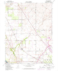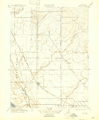
1912 Map of Nord
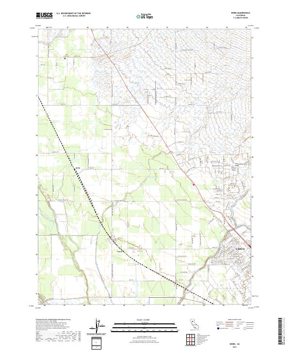
USGS Topo · Published 1947About this map
The Nord and Cana settlements anchor this northern Sacramento Valley landscape during a period of agricultural expansion and early rail transit. The Southern Pacific R R runs diagonally through the territory, establishing a transport spine that supported the local ranching and farming operations. The map reveals a structured rural society defined by its local institutions, with the Antelope School, Rock Creek School, and Webster School strategically positioned across the terrain to serve the scattered homesteads. Significant seasonal waterways, including Rock Creek and Mud Creek, drain toward the Sacramento Riv and the low-lying Sharkey Bottom. The presence of the Shasta Road and the Marysville Line indicates the importance of these overland routes in connecting Butte County to larger regional trade centers. This survey captures the transition from open range to a more settled, surveyed grid system before the intensive development of later decades.
Find a feature on this map
19 named features on this map. Tap any name to fly to it.
Don’t see what you’re looking for? This feature index may not catch every label — zoom into the map to look around manually.
Map Details
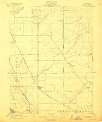
Editions of this 1912 Nord Map
2 editions found
Historical Maps of Chico Through Time
6 maps found