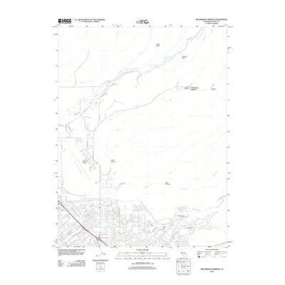
2012 Map of Richardson Springs
USGS Topo · Published 2012About this map
Richardson Springs and the northern reaches of Chico define this 2012 topographic record of Butte County. The landscape transitions from the urbanized residential grid south of Eaton Rd to the dissected slopes of Keefer Ridge and Cohasset Ridge. Hydrological patterns are central to the area's character, with Mud Cr, Sycamore Cr, and the Lindo Channel draining toward the valley. The map documents significant local infrastructure including the Chico Municipal Airport and the recreational lands around Horseshoe Lake and the Bidwell Municipal Golf Course. Further into the foothills, legacy locations such as the Old Spanish Corral and Cohasset Pioneers Spring highlight the historical routes and early water sources that supported settlement in the canyons. The presence of Iron Canyon and Cabin Hollow further illustrates the rugged nature of the terrain east of the Highway 99 corridor.
Find a feature on this map
55 named features on this map. Tap any name to fly to it.
Don’t see what you’re looking for? This feature index may not catch every label — zoom into the map to look around manually.
Map Details
Editions of this 2012 Richardson Springs Map
This is the sole edition of this map. No revisions or reprints were ever made.
Other maps of this area

1891 · Chico
USGS Topo · 1:125,000

1893 · Chico
USGS Topo · 1:125,000

1895 · Chico
USGS Topo · 1:125,000

1912 · Durham
USGS Topo · 1:31,680

1912 · Nord
USGS Topo · 1:31,680

1912 · Chico Landing
USGS Topo · 1:31,680

1912 · Keefers
USGS Topo · 1:31,680

1912 · Clear Creek
USGS Topo · 1:31,680

1912 · Singer Creek
USGS Topo · 1:31,680

1942 · Oroville
USGS Topo · 1:62,500