
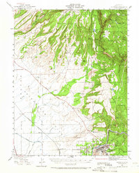
1942 Map of Oroville
USGS Topo · Published 1958About this map
The West Branch Feather River carves a deep path through this portion of Butte County, defining a landscape where early California mining and water management left clear marks. High ridges like Doe Mill Ridge and Clements Ridge overlook the transition from the Sierra Nevada foothills to the Sacramento Valley floor. In the rugged eastern half, small settlements and outposts like Yankee Hill PO, Nelson Bar, and Parish Camp are positioned near mining operations such as the New Era Mine and Bumble Bee Mines.
Find a feature on this map
104 named features on this map. Tap any name to fly to it.
Don’t see what you’re looking for? This feature index may not catch every label — zoom into the map to look around manually.
Map Details
Editions of this 1942 Oroville Map
2 editions found
Other maps of this area

1888 · Marysville
USGS Topo · 1:125,000

1888 · Smartsville
USGS Topo · 1:125,000

1888 · Bidwell Bar
USGS Topo · 1:125,000

1891 · Bidwell Bar
USGS Topo · 1:125,000

1891 · Chico
USGS Topo · 1:125,000

1891 · Marysville
USGS Topo · 1:125,000

1891 · Smartsville
USGS Topo · 1:125,000

1892 · Smartsville
USGS Topo · 1:125,000

1893 · Chico
USGS Topo · 1:125,000

1893 · Bidwell Bar
USGS Topo · 1:125,000