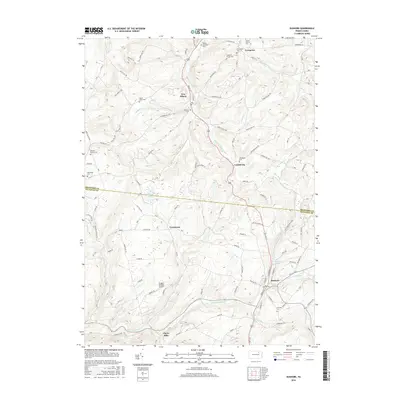
2016 Map of Dushore
USGS Topo · Published 2016About this map
New Albany and Dushore anchor this 2016 survey of the high ground straddling the Bradford Co Sullivan Co line. The terrain is defined by a series of steep drainages including the S Br Towanda Cr and Little Loyalsock Cr, which create a complex network of ridges like Hatch Hill and Dempsey Hill. The map is particularly dense with small family and community burial grounds, such as the Wilcox Stevenson Cem and Teeter Family Cem, reflecting the deep ancestral roots of these highland townships. Smaller settlements like Laddsburg, Coveytown, and Cherry Mills are connected by a web of rural routes such as Overton Rd and Gainer Hill Rd. The inclusion of Dwight's Delight Airport and Bob Kosts Pond provides a specific look at modern land use and private improvements amidst the traditional agrarian landscape of the Endless Mountains region.
Find a feature on this map
125 named features on this map. Tap any name to fly to it.
Don’t see what you’re looking for? This feature index may not catch every label — zoom into the map to look around manually.
Map Details
Editions of this 2016 Dushore Map
This is the sole edition of this map. No revisions or reprints were ever made.
Other maps of this area

1927 · Eagles Mere
USGS Topo · 1:48,000

1932 · Eagle Mere
USGS Topo · 1:62,500

1934 · Laporte
USGS Topo · 1:62,500

1943 · Monroeton
USGS Topo · 1:62,500

1943 · Powell
USGS Topo · 1:62,500

1945 · Powell
USGS Topo · 1:62,500

1953 · LaPorte
USGS Topo · 1:62,500

1953 · Eagles Mere
USGS Topo · 1:62,500

1954 · Williamsport
USGS Topo · 1:250,000

1960 · Williamsport
USGS Topo · 1:250,000