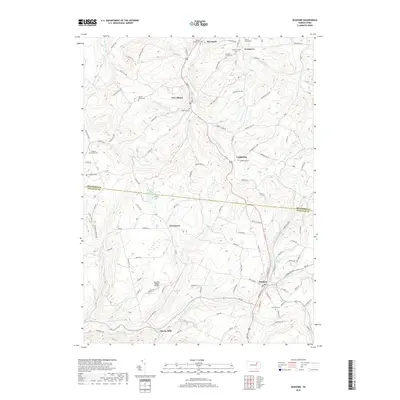
2019 Map of Dushore
USGS Topo · Published 2019About this map
Dushore and New Albany serve as the primary hubs in this section of the Endless Mountains region, where the terrain is defined by the winding course of the S Br Towanda Cr and Little Loyalsock Cr. This modern survey reveals a landscape deeply rooted in family history, evidenced by a high density of small burial grounds such as Teeter Family Cem, Heverly Family Cem, and Zadock P Corson Cem. Small rural clusters like Laddsburg, Coveytown, and Cherry Mills remain connected by a network of upland roads like Hatch Hill Rd and Dempsey Hill Rd. The map highlights the transition between Bradford Co and Sullivan Co, showing how local infrastructure like Dwight's Delight Airport and various ponds including Beaver Pond and Bob Kosts Pond sit tucked between ridges like Heath Hill and Dunn Mountain.
Find a feature on this map
97 named features on this map. Tap any name to fly to it.
Don’t see what you’re looking for? This feature index may not catch every label — zoom into the map to look around manually.
Map Details
Editions of this 2019 Dushore Map
This is the sole edition of this map. No revisions or reprints were ever made.
Other maps of this area

1927 · Eagles Mere
USGS Topo · 1:48,000

1932 · Eagle Mere
USGS Topo · 1:62,500

1934 · Laporte
USGS Topo · 1:62,500

1943 · Monroeton
USGS Topo · 1:62,500

1943 · Powell
USGS Topo · 1:62,500

1945 · Powell
USGS Topo · 1:62,500

1953 · LaPorte
USGS Topo · 1:62,500

1953 · Eagles Mere
USGS Topo · 1:62,500

1954 · Williamsport
USGS Topo · 1:250,000

1960 · Williamsport
USGS Topo · 1:250,000